
Tsubame was a Japanese naval vessel built after World War I. During World War II, she was attacked by U.S. forces and sank off Miyakojima on March 1, 1945. The ship still rests on the seafloor, quietly marking the passage of time together with those who died. However, her exact location has not yet been confirmed.
This project is being pursued in response to a direct request from the family. We consider it an effort of exceptional significance—both as an opportunity to honor the wishes of the bereaved family, and as an undertaking that contributes to war remembrance as well as the investigation and preservation of underwater cultural heritage.
Whether the ship can be found remains uncertain. Still, if our technical capability can help—even in part—and support remembrance and further research, we would be grateful.
Tsubame was the lead ship of the Tsubame-class minelayers, built in Japan after World War I. The sister ship of the same class was Kamome. According to Nihon Kaigun Go’eikan-tei Shi, the Tsubame-class is positioned as a prototype of a modern-style minelayer.
At that time, minelayers were vessels intended to lay naval mines, anti-submarine nets, and navigation markers. During wartime, their roles expanded to include missions such as coastal defense and convoy escort.
Both Tsubame and Kamome were lost in the Southwest Islands area (from the southern tip of Kyushu to northeast Taiwan). This project focuses on Tsubame, which sank off Miyakojima on March 1, 1945.
Principal particulars
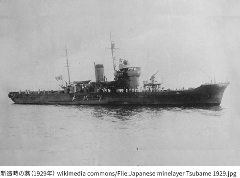
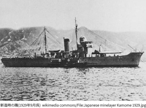
Tsubame was a relatively small warship, with a wartime planned complement of approximately 80 personnel.
According to Sakishima Islands Operation (Miyako Volume), Tsubame departed Sasebo on February 13, 1945, escorting two transport ships. Despite being attacked several times along the way, she arrived at Miyakojima in the early morning of March 1.
By then, however, she appears to have already been detected by enemy patrols. Not long after she dropped anchor, she came under attack by U.S. fighter aircraft, and a large-scale attack followed in the early afternoon. She sank that same day, toward evening. It is stated that more than 70 personnel, including Captain Takeo Yoshida, were killed in this action.
Other records indicate that around 40 surviving crew were incorporated into existing forces on Miyakojima. Because these figures do not align cleanly with the planned complement, it is believed that accurate records of casualties may not remain.
Even the type of attacking U.S. aircraft is unclear: some sources describe it as F6F Hellcat, others as F4U Corsair, and misidentification was reportedly common at the time.
Although I have dived many war wrecks, at first I did not have sufficient knowledge about Tsubame. The turning point was meeting Takamatsu Gushiken, who continues remains-recovery activities related to the Battle of Okinawa. Through connections formed with him, I was approached around February 2025 with information that a bereaved family member was seeking advice regarding an underwater exploration of Tsubame.
After conducting more detailed interviews in autumn 2025, it became clear that the requester was Susumu Yoshida, the eldest son of Tsubame’s captain, Takeo Yoshida. I also learned that searches had been attempted in the past with cooperation from a local dive shop, but the wreck had not been found. Considering Mr. Yoshida’s advanced age, I felt the exploration should be pursued without delay.
From the materials provided, we confirmed the following situation:
The bereaved family’s wishes regarding recovery were also featured on NHK “Ohayo Nippon” (April 10, 2025), where Mr. Yoshida’s feelings were shared.
The handling of underwater human remains has also drawn increasing social attention in recent years. The government stated a policy in 2020 to proactively collect information when there is a risk that the dignity of remains may be harmed; however, because Tsubame itself has not been found and remains are not exposed to public view, it is not currently included in official national investigation targets.
Given that earlier dives had failed to locate the vessel, we considered the following possibilities regarding her present state:
Given that the charted depth is relatively shallow (25 m) and the wreck remains undiscovered, it is also possible that the hull is damaged or buried in sand, which would make the search extremely difficult.
On the other hand, even if a hull has broken apart, items such as ceramics often endure corrosion and remain. If the chart position is correct and the site is not buried, there may still be a chance of discovery. Additionally, if the true wreck site lies deeper than the charted position, the likelihood that the hull remains more intact may increase.
Based on these considerations, preparations began to conduct the exploration as early as possible.
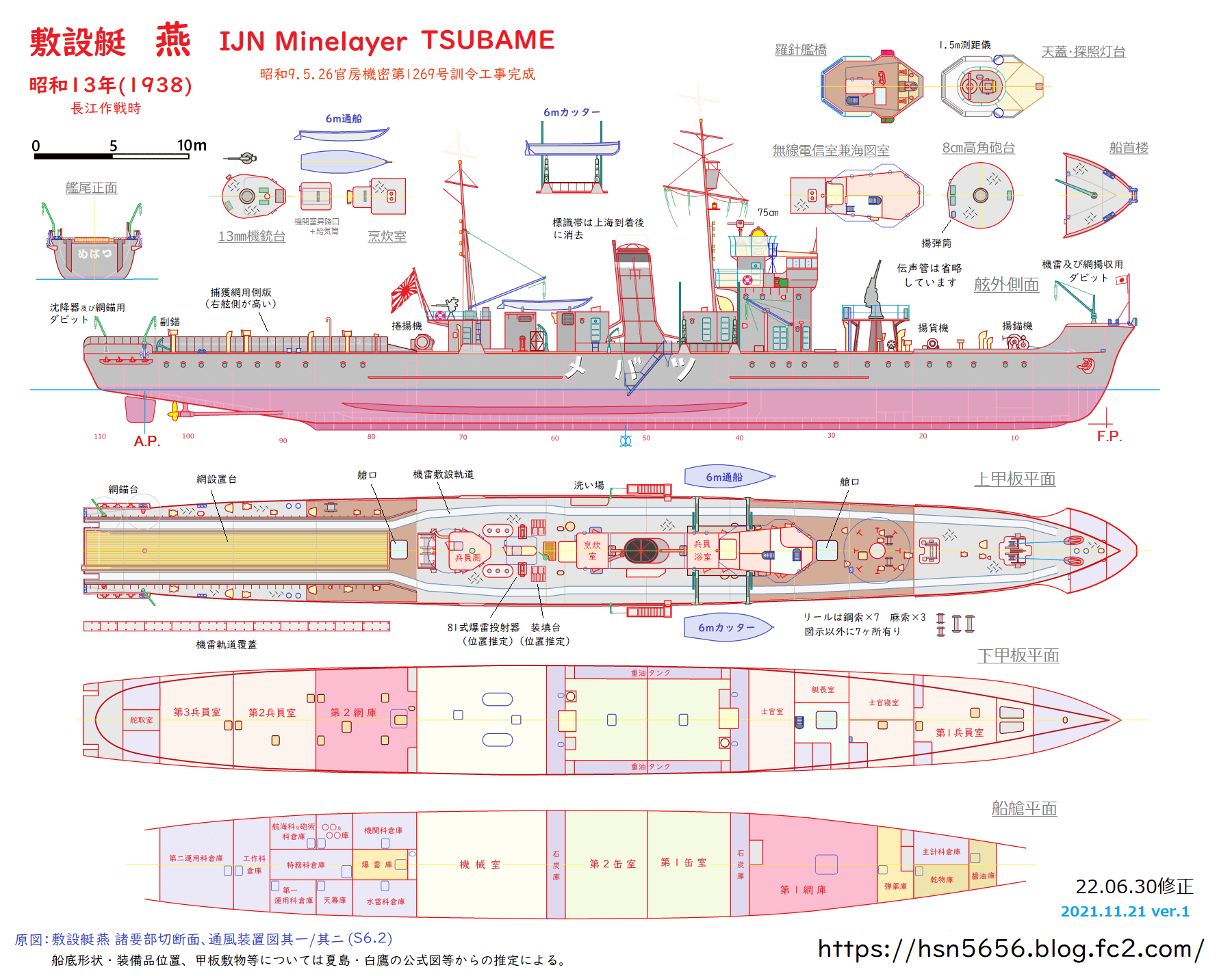
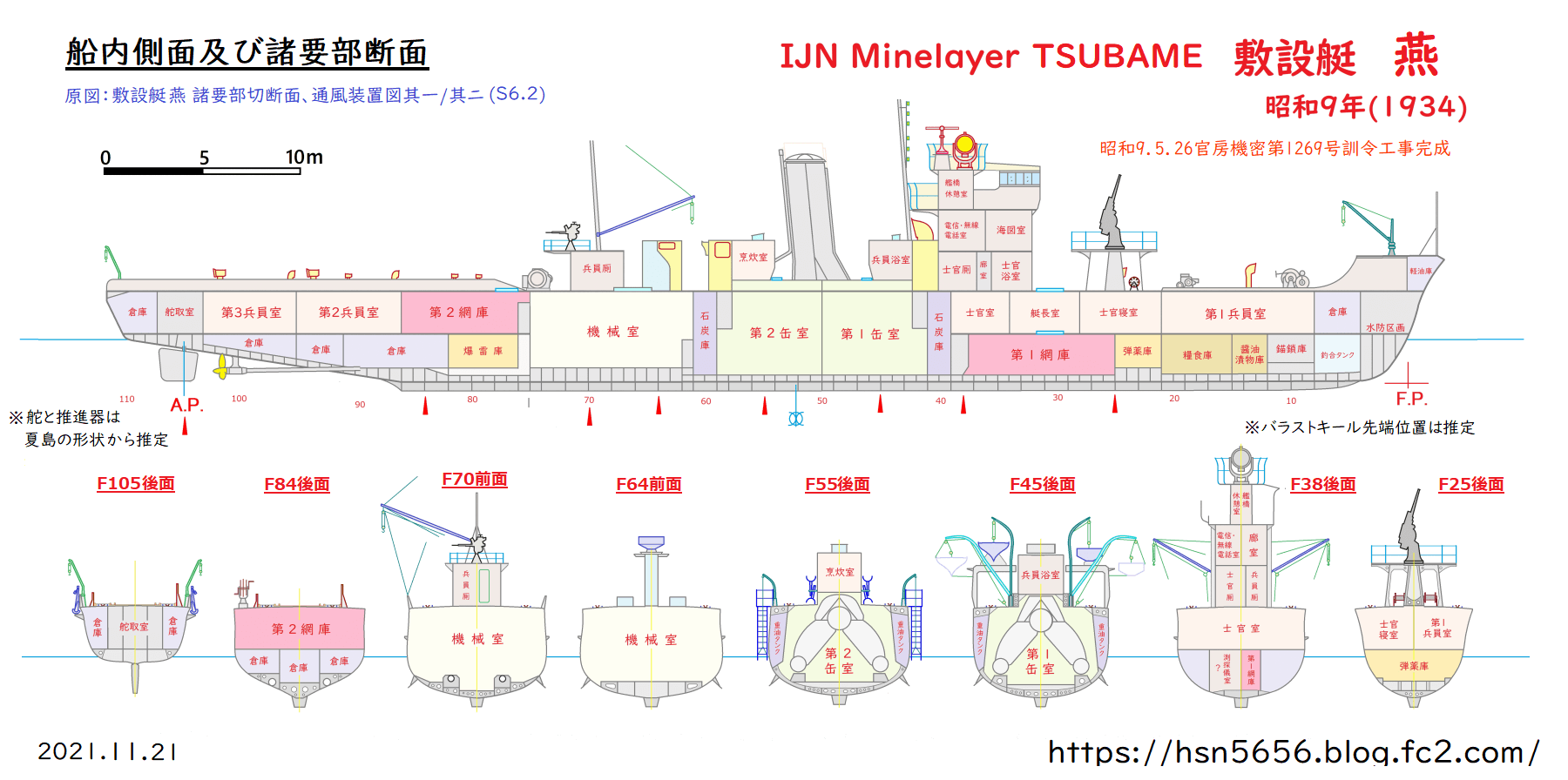
Before diving a wreck, I make it a habit to study its history and, when possible, plans and drawings. This is both because “diving a wreck can be seen as diving into its history,” and because understanding the structure improves safety and efficiency in the field.
For Tsubame, however, available materials were extremely limited and information on internal layout and structure was fragmentary. In that situation, we identified an individual who had created and published illustrations from drawings for model-building purposes. After making contact, we were kindly granted permission to use those illustrations. These materials are valuable not only for understanding the hull structure, but also for improving search effectiveness and exploration safety.
Mr. Susumu Yoshida had previously asked DIVE Miyakojima (Owner: Hirokazu Sunagawa)—a long-established local dive shop run for more than 30 years—to attempt underwater searches. This shop is also where Mr. Yoshida and his son and daughter had enjoyed recreational diving.
For this project, we contacted Mr. Sunagawa in advance and conducted an on-site meeting (with media presence) to confirm previous search efforts, understand the current situation, and align on future direction.
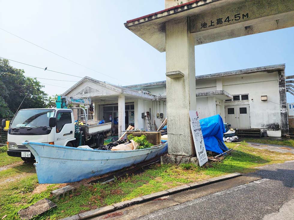
DIVE Miyakojima
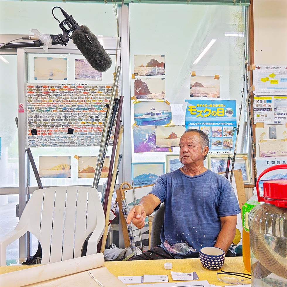
Mr. Hirokazu Sunagawa
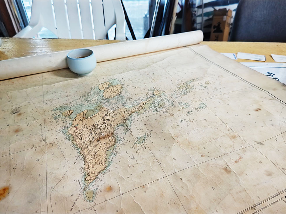
Nautical chart of the location where Tsubame sank
Among the materials provided by Mr. Yoshida was a record from a January 30, 1982 memorial service, including a “Miyako Islands map” marking a point labeled “Tsubame.” A wreck symbol was also shown in the same area on a nautical chart Mr. Yoshida had photographed.
Because the production date of that chart was unclear, the latest charts were checked. Two nearby wreck symbols were identified:
Mr. Sunagawa told us that sonar had detected a response at the 45–50 m location, believed to be an artificial structure. This increased the possibility that the hull may remain to some degree in recognizable form at that deeper point.
Both candidate points lie directly beneath a shipping route and are not places where recreational divers can normally dive—consistent with why the wreck may not have been found to date.
Information was also shared that a memorial monument may be visible near the southern end of Karimata Beach. Although it could not be confirmed that day due to bad weather, the monument is also described in the 1982 memorial-service materials, and it may be a memorial for Tsubame. If confirmed, it would be a strong piece of evidence supporting the sinking in this area.
During the visit, we also met with local media in Miyakojima and were able to gather valuable documents and information related to Tsubame, with gratitude expressed to all who cooperated.
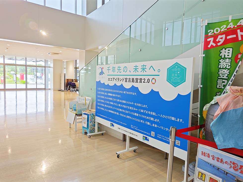
We announced the dive exploration of the minelayer Tsubame at a press conference at the Okinawa Prefectural Government press club.
As the announcement came on short notice, we were unsure how many media outlets would attend; in the end, nearly all media related to Okinawa Prefecture came to the conference.
There, I explained how this project had been brought to me by Takamatsu Gushiken, whom I had come to know through the Chosei Coal Mine investigation; my thoughts on taking part; and the specific diving methods to be used.
Cases in which a direct child of a war casualty is still living are becoming increasingly rare. I feel strongly that, while Mr. Susumu Yoshida—who holds a deep wish for this search—is still with us, we should do all we can to help.
As for the dives themselves, I explained that because the sites lie along a shipping route and carry a risk of drifting, our plan includes large DPVs (underwater scooters) so that we can leave the route area and reach the shore on our own in an emergency.

Photo courtesy of The Ryukyu Shimpo, from the article of February 21, 2026 (listed below)
Related Coverage (Ahead of the March 2026 Dives)
On February 28, 2026, the day before the dive, I arrived on site with my dive buddy Yudai Uchida for equipment preparation and final briefings. After preparing the rebreathers, tanks, underwater scooters, and camera equipment we had brought, we visited the dive shop DIVE Miyakojima for a final review of the dive plan with the boat captain and other members involved, in preparation for the dive on March 1.
On the day, of the two points judged promising from the charts, we decided to prioritize the deeper candidate point at 45–50 m, where Mr. Sunagawa had said a fish finder had previously shown a response. One reason for starting with the deeper point was that the shallower one could be explored by divers other than myself.
As Mr. Sunagawa had not recorded the location of that earlier response, we searched for it with the fish finder before diving. Uchida then confirmed on the fish finder a rectangular echo rising vertically about 4–5 meters from the seabed. Judging from its shape that it was highly likely to be an artificial structure, we decided to dive on that point.

Nautical chart during the passage. The position shown does not indicate the candidate wreck site.
Searching underwater
For the dive, we deployed an SMB (surface marker buoy) so that the boat could track the divers' position at all times, and dived carrying a reel connected by line to the SMB.
Visibility was about 10 m near the surface and about 15 m below 20 m depth—somewhat low for the waters around Miyakojima.
By the time we had descended to around 35 m, no clear artificial structure had been sighted. We considered that our descent point was likely off target, but taking into account that:
we chose to continue searching underwater rather than re-descend.
We searched for about 35 minutes, running the underwater scooters at 35–40 m, where the seabed was visible. When our decompression obligation reached about 20 minutes, we ended the dive as a matter of safety management.
Although this dive did not result in visual confirmation of an artificial structure, the boat captain, Mr. Ikema, recorded the vessel's track for us, and the dive laid important groundwork for what comes next: we narrowed down the candidate points, established a workflow for the dives, and came to know the environment. As many changes occurred on the day, we believe that more precise advance briefings will make accurate descents onto the candidate points possible.
After the dive, at the Miyakojima City facility "Hataraku Josei no Ie" (Working Women's Center), we reported the results and future plans to Mr. Susumu Yoshida and his family, who had requested this exploration, and to members of the press.
Mr. Yoshida spoke about his own search efforts to date and about his late father, Takeo, and offered strong words of gratitude and expectation for this exploration.

Mr. Yoshida speaking to the press

Explaining the fish-finder echo
Yudai Uchida and I (Yoshitaka Isaji) also gave technical explanations of how candidate points are identified with the fish finder and of the extent of this search. This provided an opportunity to show publicly that the exploration is proceeding in a staged and planned manner.
Through this trip we came to understand the environment, dived from the boat we will be using, and established a working rhythm with the captain. As candidate points have been identified, we believe a few more dives would allow us to check the currently listed points and at least confirm whether an artificial object is present there.
After the briefing, we accompanied Mr. Yoshida on the memorial visit he makes every year.
From the place on Irabu Island where Mr. Yoshida holds his memorial visits, one can look out over the dive area—the waters where Tsubame sank. Seeing Mr. Yoshida gazing at the sea there, I felt anew how much this project means.
Mr. Yoshida offered to the sea a bottle of Suntory whisky Kakubin, which his father was said to have loved. I strongly felt that, when we find Tsubame one day, I too would like to make an offering at that place, on the water.

Mr. Yoshida looking toward the estimated sinking site
Related Coverage (On the March 1, 2026 Dive)
Where the same outlet reported multiple times, some items are omitted.
Due to poor sea conditions after March 1, the second dive was carried out after a four-day interval.
The aim of this dive was to relocate and visually confirm the echo point detected on March 1. We held detailed advance briefings with the captain to improve descent accuracy and operations, and Dan Mibayashi joined as surface support to strengthen the team.
In the re-search on site, however, the clear artificial-structure echo seen previously could not be reproduced. Some similar responses were observed, but we could not be certain they were at the same point as before. I regret that I had left the earlier confirmation to others rather than checking it with my own eyes.
At a position slightly off from the point recorded on March 1, there was an echo that made us wonder whether it might be artificial; but Uchida, who had watched the fish finder on March 1, remarked that the earlier echo had looked more clearly artificial, so it remained inconclusive.
We therefore conducted an areal search by underwater scooter over the roughly 150-meter stretch between the wreck symbol and the suspect echo point. This allowed us to cover the south-to-west sector of the area—an arc of about 90 degrees.
Visibility was worse than on the first dive—under 15 m near the seabed—but we continued the wide search by scooter at about 40 m depth, managing our bearing by compass.
Believing that our descent had not been far off this time, we searched at around 40 m while monitoring our heading by compass.
In the end, no structure that could be identified as a wreck was confirmed. We judged the likelihood of the wreck lying in that sector (the south-to-west arc of about 90 degrees) to be low, and ended the dive.
Nautical chart during the passage. The position shown does not indicate the candidate wreck site.
After the explorations, information reached us from a person involved in technical diving in Miyakojima who had actually dived near the wreck symbol and seen a sunken vessel.
According to this account, the actual hull may lie on the opposite side of the wreck symbol. It was also pointed out, however, that the vessel may be a cargo ship that sank about 40 years ago, and whether it is Tsubame is unknown.
Even so, this information is an important clue for the search ahead, and confirming it on site is of great value.
It came to us because we had begun the exploration and shared information publicly—a case that underscores the importance of starting an exploration, and of making it public.
These explorations made clear that the uncertainty of the sinking position is greater than expected.
With this in mind, we are considering carrying out the exploration ahead in the following three phases:
We plan to conduct the sonar survey as soon as a cooperating vessel is secured, combining the three phases above as we proceed.
We are also considering crowdfunding around the same time to secure the necessary funds.
To restate: the purpose of this project is to find and document Tsubame, and to answer the wishes of the bereaved family. We are therefore not fixated on being the ones to find her; what matters most is that Tsubame be found soon.
If readers of this report, or those who learned of Tsubame through the news, take up the search themselves, that would be exactly what our information sharing is meant to achieve—and we would welcome it.
Related Coverage (On the Tsubame Exploration as a Whole)
The crowdfunding campaign to secure funding, mentioned in our plan as of March 22, 2026, was subsequently carried out.
As a result, 669,010 yen was raised through the campaign, and additional donations were also received. We would like to express our deep gratitude to everyone who supported the campaign, and to all those who organized and ran it.
Preparations are now complete for the first phase of the plan: a wide-area sonar survey.
We looked for a cooperating vessel on the condition that it be equipped with sonar, and a local fishing boat in Miyakojima has agreed to work with us. While the fish finder used in the March explorations detects what lies directly beneath the boat, sonar can search a much wider area around it.
The search plan reflects the area already covered by the March dives (the approximately 90-degree arc to the south and west) and the information we have received; at the same time, we intend to use this opportunity to search broadly across the entire area. The team will consist of the boat captain and, as in March, Yudai Uchida and myself.
We also hope, if conditions allow, to look for the memorial monument said to stand near the southern end of Karimata Beach. If the monument can be confirmed, it will offer insight into how the local community has preserved the memory of Tsubame.

At the studio of RBCi Radio's "Up!!"
As described above, after the March dives we received information from someone who had actually seen a hull near the wreck symbol. This experience showed us that making the exploration public and sharing information can itself move the search forward.
Ahead of the sonar survey, we therefore appeared on two radio programs in Okinawa to call for information from a wider audience: RBCi Radio's "Up!!" on August 4, and FM Miyako's "Southern Morning" on August 10.
We asked listeners for the following:
For the former, we are looking for accounts of any of the following: a place where fishing nets tend to snag, a spot where a fish finder shows a ship-like echo, or a firsthand sighting of something that looked like a vessel. If any of this sounds familiar, we would be grateful if you could contact DIVE Explorers.
Whether these calls will bear fruit remains to be seen. But as the March example shows, sharing information can bring in unexpected leads. We are deeply grateful to everyone at RBCi Radio and FM Miyako for so generously giving us the opportunity to make this appeal on their programs.
In addition, prompted by news coverage of our exploration, testimony from a person who witnessed the sinking of Tsubame, as well as a recorded account left by a surviving crew member, have been brought to news organizations. Like the information we received after the March dives, we regard these as outcomes of making the exploration public.
The wide-area sonar survey will take place on August 18–19. It will cover not only the vicinity of the wreck symbols but the entire area where Tsubame is thought to have sunk.
If the survey yields promising candidate locations, we plan to conduct confirmation dives in mid-September. In those dives, we will first carry out filming only, without altering the site in any way, and decide on subsequent steps based on the results.
Affiliations may not be up to date.



Copyright © 2024 Japan Karst & Underwater Exploration Project