
Atetsu-dai is a limestone plateau in northwestern Okayama Prefecture, spanning the cities of Niimi, Maniwa and Takahashi. Deeply cut by rivers such as the Takahashi River, it is divided into a number of smaller plateaus, among them Kusama-dai and Toyonaga-dai, at elevations of roughly 350–500 meters.
The limestone that forms the plateau belongs to the Akiyoshi Belt, as does that of Akiyoshidai in Yamaguchi Prefecture, and is reef limestone that formed on the summit of a seamount. Its distribution is said to be about as extensive as that of the limestone of Akiyoshidai, Hiraodai and Taishakudai.
The plateau holds many caves: based on records from 1979, 81 are listed across the whole of Atetsu-dai.1)
The show caves Ikurado and Makido, together with Himesaka-kanachiana (written with different characters in the prefectural designation), Uyamado, Suwa-no-Ana and others, are designated together as the Okayama Prefectural Natural Monument “Atetsu-dai.” At one of them, Himesaka-kanachiana, a person went missing in the subterranean lake at its far end in January 2008, and Niimi City prohibits entry to the cave (as of October 2026).
Records of these caves have been built up through descriptions by Akira Shibata and others from the 1960s onward, and through the surveys that the Okayama University Caving Club has carried on since the 1970s. The Speleological Society of Japan held the “Atetsu-dai Cave Colloquium” in Niimi City in 2015 and 2017. In recent years, too, local caving clubs have reported the discovery of new spaces.
This project is an effort to explore and record, by diving, the water that flows beneath Atetsu-dai.
On a limestone plateau, water that soaks in from the surface passes through underground caves and emerges at the edges of the plateau. At Atetsu-dai, too, two kinds of cave opening are known: swallow holes that open at the bottom of dolines (bowl-shaped depressions), and resurgences that open on the slopes at the edge of the plateau. Himesaka-kanachiana is a typical example of the former; Ikurado and Suwa-no-Ana are typical of the latter.1) There is a record of 5,100 m³ of groundwater a day issuing from Ikurado.2)
In the valleys that run down the steep slopes at the edge of the plateau, a porous, loosely cemented stone called tufa forms. It covers the steps of the valleys in staircase-like tiers, or clings like scales to the faces of small waterfalls. When water that has dissolved limestone underground emerges at the surface, the carbon dioxide dissolved in it escapes, and the calcium carbonate that can no longer stay in solution is deposited, little by little, on the valley floor and on the surface of moss washed by the water. What builds up in this way is tufa. A study of the tufa of Atetsu-dai distinguishes tufa from other deposits of the same calcium carbonate: deposits formed inside limestone caves are called speleothems, and those deposited from hot-spring water are called travertine.1) In Japanese, all of these are sometimes referred to collectively as sekkaika (calcareous sinter), and the term travertine is also sometimes used in a broader sense that includes tufa. On this page, the terms tufa, travertine and speleothem are used in the same sense as in that study.
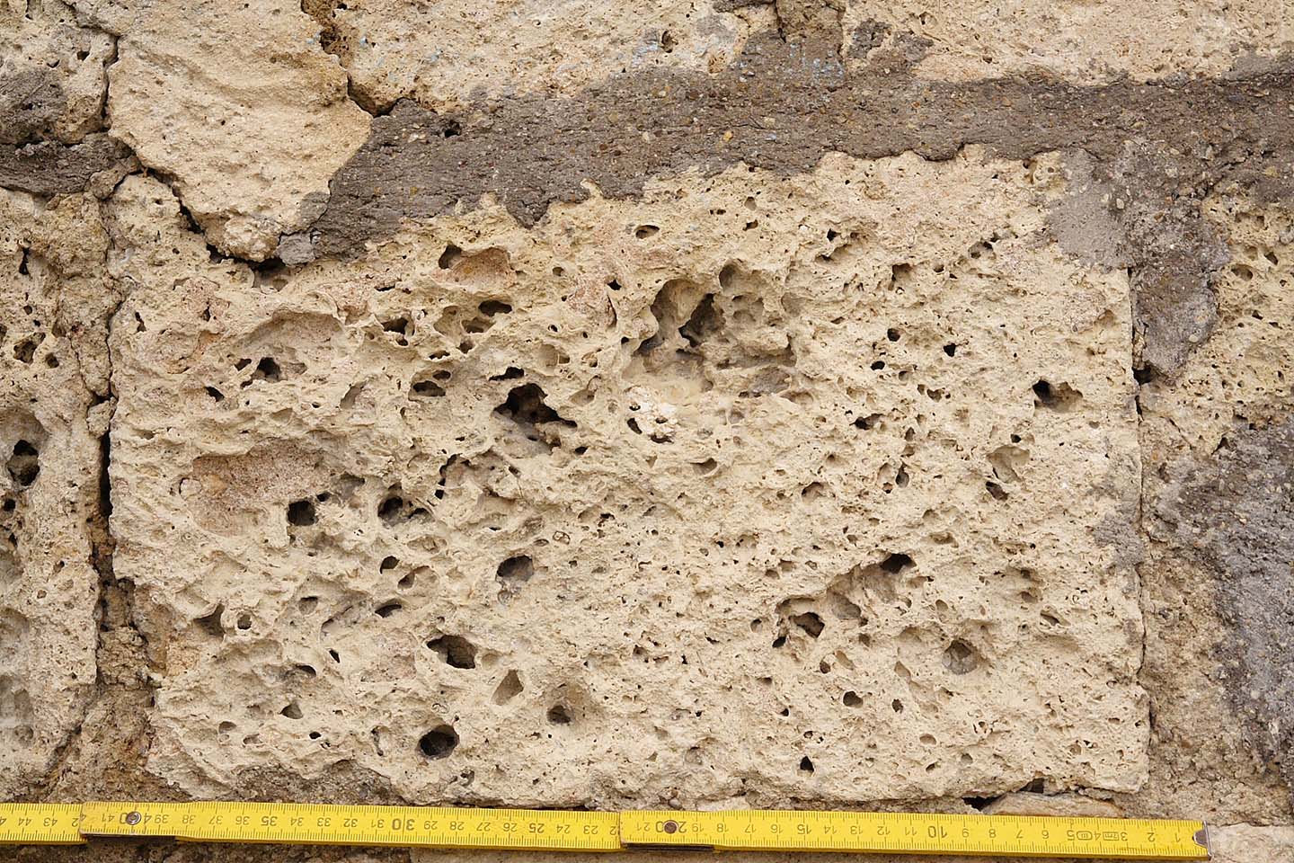
※ A cut block of tufa (in a bastion of Hohentübingen Castle, Germany, 1606) / Photo: Ustill, “Kalktuff-Block Schloss-Tuebingen 2” (Wikimedia Commons) / CC BY-SA 2.0 DE
Locally, tufa has long been known as suiganseki (literally, “water rock”). In places such as Ueno in Takahashi City it was quarried for ornamental use until 1995, and it was sold at souvenir shops at Ikurado and Makido. Atetsu-dai is the area with the densest concentration of tufa in Japan: as of 1999, 36 sites were known at Atetsu-dai, compared with one at Akiyoshidai and two at Taishakudai.
One reason there is so much tufa at Atetsu-dai is thought to be that there are many places where the boundary between limestone and other rocks is exposed on the steep slopes at the edge of the plateau; the study suggests that such places are few at Akiyoshidai and Taishakudai. It has also been suggested that, although the data are limited, the water of Atetsu-dai tends to contain more dissolved calcium carbonate than that of Akiyoshidai and elsewhere, and that this may be another reason.1)
Among the caves of Atetsu-dai, Himesaka-kanachiana is one of the largest swallow-hole caves in the prefecture. Its total length is given as about 1.7 kilometers in Okayama Prefecture’s description and as 2,128.5 meters or more in the survey by the Okayama University Caving Club, and at its far end lies a subterranean lake more than 30 meters deep. Yet no record can be found that confirms where the water of this lake drains to. On the other hand, a local tradition holds that Himesaka-kanachiana connects to Suwa-no-Ana in Shimoazae,3) and submerged sections have been confirmed in Suwa-no-Ana.
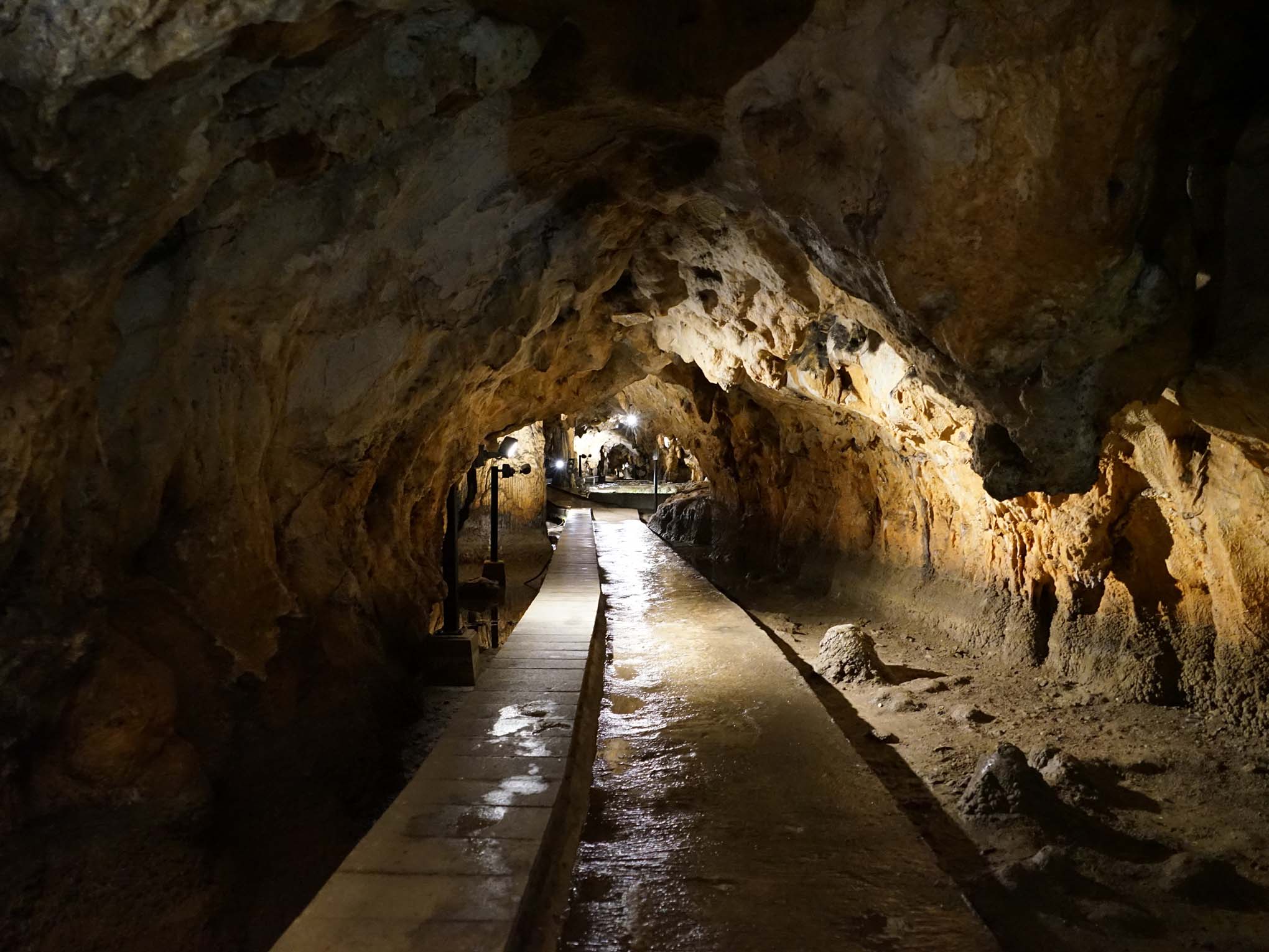
※ Makido (Niimi City, Okayama Prefecture) / Photo: HKT3012 (Wikimedia Commons) / CC BY-SA 4.0
Cave exploration at Atetsu-dai has, in many places, come to a stop on reaching water.
“Kami-no-Ike” (literally, “Pond of the Gods”), partway into Himesaka-kanachiana, is a point that, except in the dry season, lies under water and cannot be passed. Around 1971, an investigation team led by Akira Shibata is said to have walked through it in the dry winter season and found about 700 meters of cave continuing beyond.
While research on caves, geology and hydrology on land has accumulated, records of underwater investigation have scarcely been published. As far as we could find in the general index of the Speleological Society of Japan’s publications and the records of its scientific presentations, all the articles and presentations on Atetsu-dai concerned investigation and description on land, or hydrology.
Our work at Atetsu-dai began with information from Yuki Fujii (Ukigumo Caving Club / Speleological Society of Japan), a caver whose home ground for exploration is Atetsu-dai.
Fujii and colleagues have presented findings at the Speleological Society of Japan, such as the discovery of new spaces in Uyamado and hydrological connections. Through our exchanges at the Speleological Society of Japan and during our investigations at Akiyoshidai, we heard about Atetsu-dai and received information on places that could become candidates for diving.
The more we learned about Atetsu-dai, the more we saw qualities that set it apart from nearby Akiyoshidai. Though its limestone belongs to the same Akiyoshi Belt, Atetsu-dai is divided into many small plateaus, and the edges of those plateaus hold the greatest concentration of tufa in Japan. That difference is interesting, and Atetsu-dai could also serve as a point of comparison with Akiyoshidai. We look forward to seeing how these qualities appear in the water, and what new things we may find there.
Underwater records of Atetsu-dai are even fewer than those of Akiyoshidai. We believe that the underwater records we make and report will be useful to many future investigations.
Shimoazae-no-Agari is a spring cave in Shimoazae, Maniwa City.
Just inside the cave entrance there is a spring pool, and the entrance leads almost directly into a submerged passage. The water of the pool is still, and no water can be seen flowing out of it. The area around the pool has been worked by human hands — stone walls built and steps put in — suggesting that it was once in use.
We have heard secondhand that the cave was dived once in the past, but in our searches of literature databases and the web, we found no material recording a dive in it.
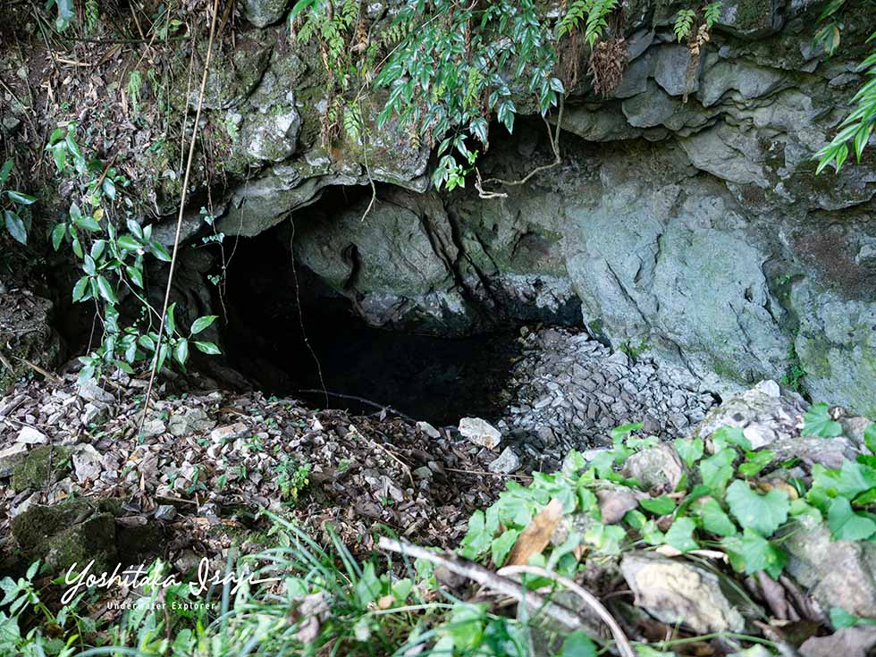
※ The entrance of Shimoazae-no-Agari
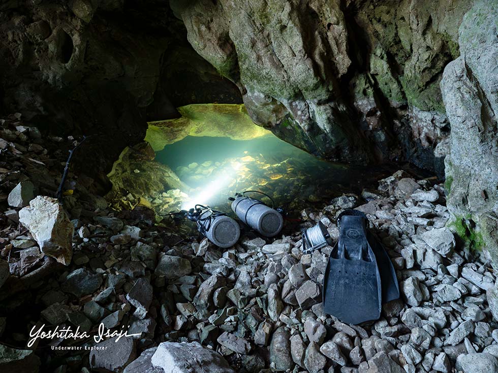
※ The spring pool just inside the entrance, where the underwater passage begins.
The purpose of this dive was to find out whether Atetsu-dai could become a target for future diving, what kind of underwater environment it holds, and what preparation it would require.
As this was our first dive at Atetsu-dai, we took only a single reel of line (a thin rope that divers lay through a cave to secure their way in and out), so as to limit how far we would go.
Before the dive, we notified the Maniwa City Board of Education, the fire department and the police.
Near the entrance the passage is relatively narrow, and forms such as bedrock carved into pothole-like hollows suggest the influence of a fairly weak current.
About 15 meters into the water, the passage widened a little and there was more deposited silt, and the visibility, which had been about 5–6 meters at the starting point, appeared to drop slightly.
There was also a certain amount of percolation (when exhaled bubbles strike the walls and ceiling, the silt clinging to them falls), which means that, although there is a current, the flow does not become very strong.
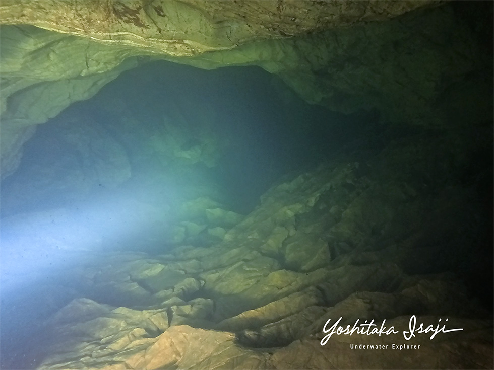
※ The passage just after we began the dive from the spring pool
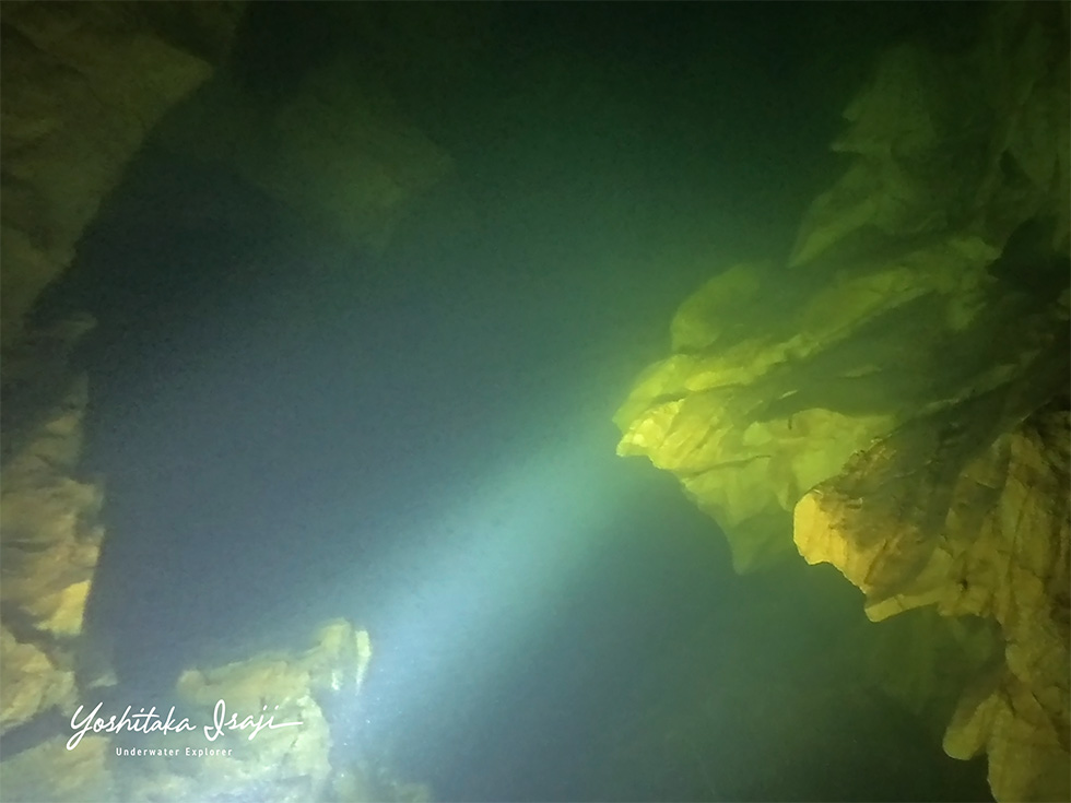
※ The passage a little further in
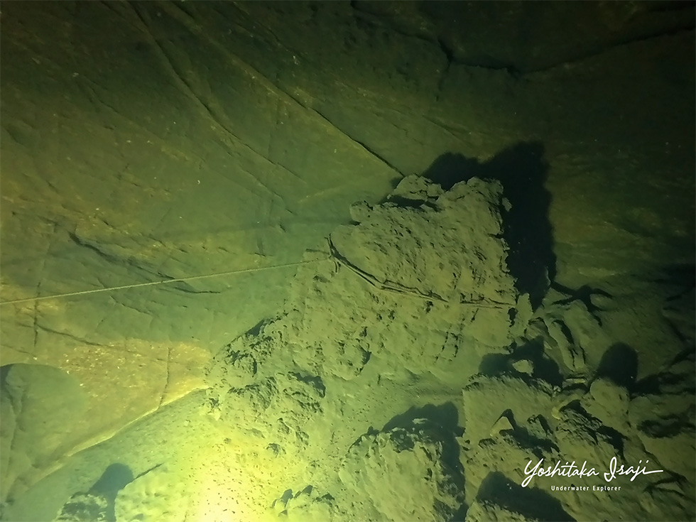
※ The end of the line laid during a past dive
About 20 meters in from where we entered the water, we came upon a line laid during a past dive.
The line remained unbroken, but rather than rely on a line whose condition we could not verify, we laid our own line as we advanced, for safety.
Along the way there were several places that looked like side passages, but this time we gave priority to exploring the main passage and did not go to check them.
The existing line ended about 120 meters further in, where its end had been tied off.
About 20 meters beyond that, we used up the line we had brought in, so we turned back, recording as we went.
Beyond the point where we turned back, a passage of about the same size continued, leaving us looking forward to future exploration.
The passage is about 3 meters wide in many places and about 7 meters at its widest, with a similar height. In the section we dived this time, the maximum depth was about 8 meters; the passage is almost level overall, with only some ups and downs in places.
Along the way there were a number of air pockets (spaces where air has collected between the ceiling and the water surface), with stalactites hanging from their ceilings.
Below the water surface, on the other hand, we saw no speleothems in the areas we looked at. We did not see everything, but we think this may be due to erosion by the flowing water.
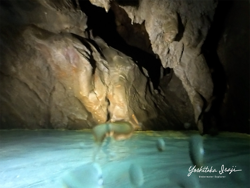
※ An air pocket partway along the passage
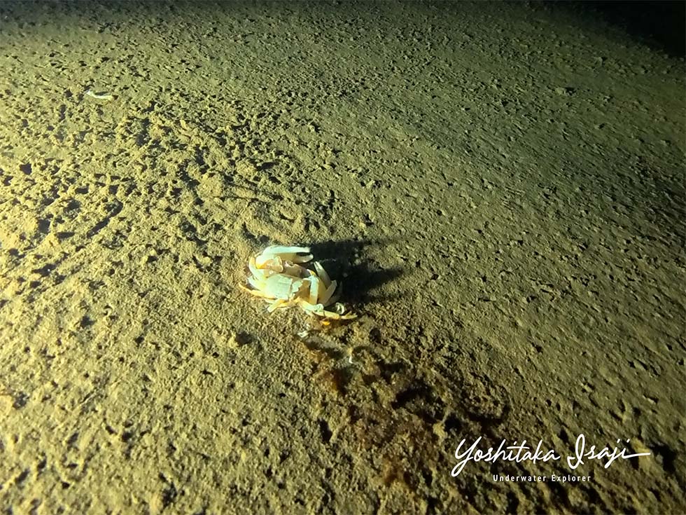
※ The silt floor about 30 meters from the entrance, where a crab’s molted shell remained almost intact.
The water temperature remained at 15°C throughout the dive. Visibility was 5–6 meters in undisturbed water (there had been no rain in the preceding days). On the way back, percolation reduced visibility to about 1–2 meters.
Inside the cave there was a current that seemed to push us back from the far end, giving the impression of an underground-river cave — a cave through which a river flows. Since the water in the spring pool at the entrance is still, we take the view that the pool opens to the side of the flow path, and that the current in the cave slips away downstream through gaps in the rock at a point a short way in from the pool.
Even so, the current was weak, and silt deposits were observed on the floor in many places.
Through this dive, we were able to grasp what type of underwater caves Atetsu-dai has, along with the water temperature, visibility and other conditions that are probably much the same in almost any of its caves. The results of the dive were compiled into a report and sent to the Maniwa City Board of Education.
We believe this dive allowed us to judge that the caves of Atetsu-dai, including Shimoazae-no-Agari, can be targets for diving investigation in the future, and we would like to carry on with our exploration.
On the evening after the dive, we were invited to a gathering of members of the caving clubs (including the Ukigumo Caving Club) that continue to explore Atetsu-dai.
We are grateful to Yuki Fujii, who provided information on candidate dive sites and also helped us submit our cave-entry plan.



Copyright © 2024 Japan Karst & Underwater Exploration Project