
Miyako Island is an island of Okinawa Prefecture located about 300 km southwest of Okinawa Main Island. It has an area of approximately 158.5 km² and a population of about 55,000.
The entire island is formed of limestone derived from uplifted coral reefs, and this geological characteristic has created the diverse cave environments unique to Miyako Island.
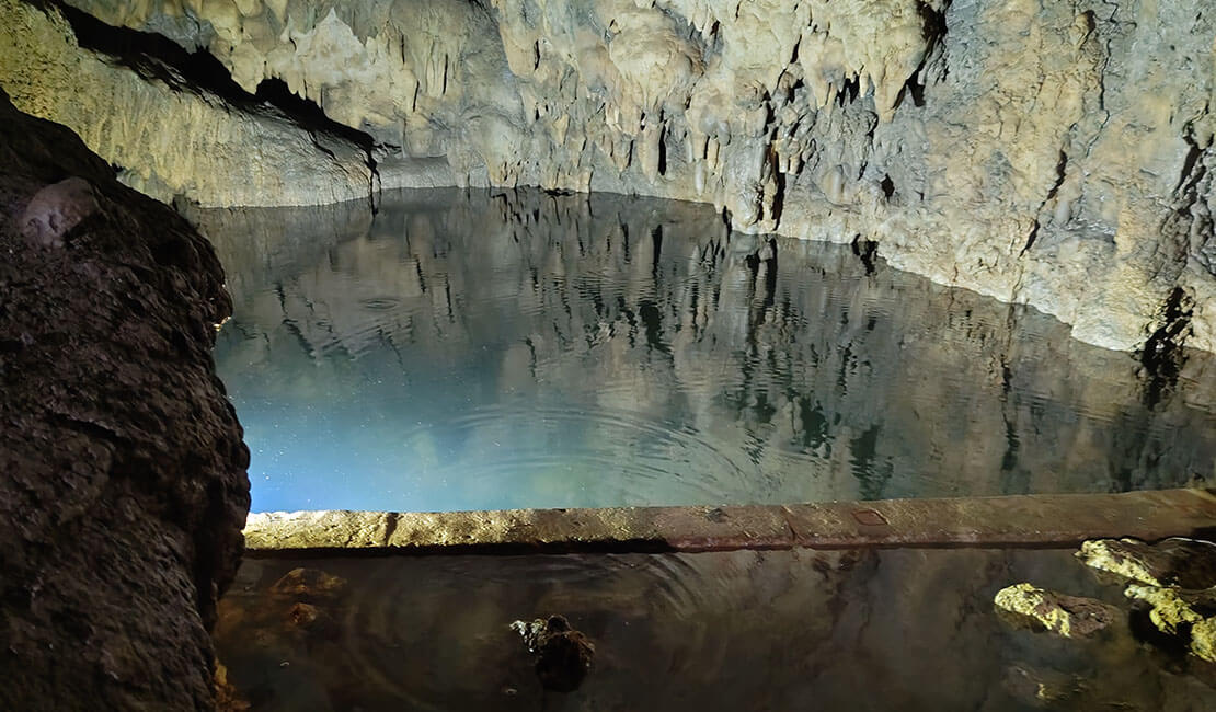
Because limestone is easily dissolved by rainwater and groundwater, limestone caves form over long periods of time. In coastal areas, caves are also formed by dissolution caused by seawater. As a result, Miyako Island has many caves, both on land and underwater. Some land caves are known as tourist sites, and many underwater caves attract attention from divers in Japan and abroad.
In this project, among these various caves, we focus on the “subterranean lakes” located in the deeper parts of land caves and investigate their underwater environments.
The geological structure of Miyako Island can be broadly divided into the following three layers:
Because the highly permeable Ryukyu Limestone overlies the relatively impermeable Shimajiri Layer, groundwater tends to accumulate near the boundary between them, and subterranean rivers and subterranean lakes are thought to form there.
These strata are not distributed uniformly in horizontal layers. In some places, the Ryukyu Limestone is exposed at the surface, and in other places the thickness of the layers changes significantly.
In addition, faults running roughly north-northwest to south-southeast are developed on Miyako Island, and groundwater is believed to flow along these faults, appearing as springs and subterranean lakes in the deeper parts of caves.
Making use of these geological and groundwater conditions, Miyako Island is home to the world’s first underground dam, which forms the basis of the island’s water resource management.
References on geology and groundwater consulted for this research are listed at the end of this page.
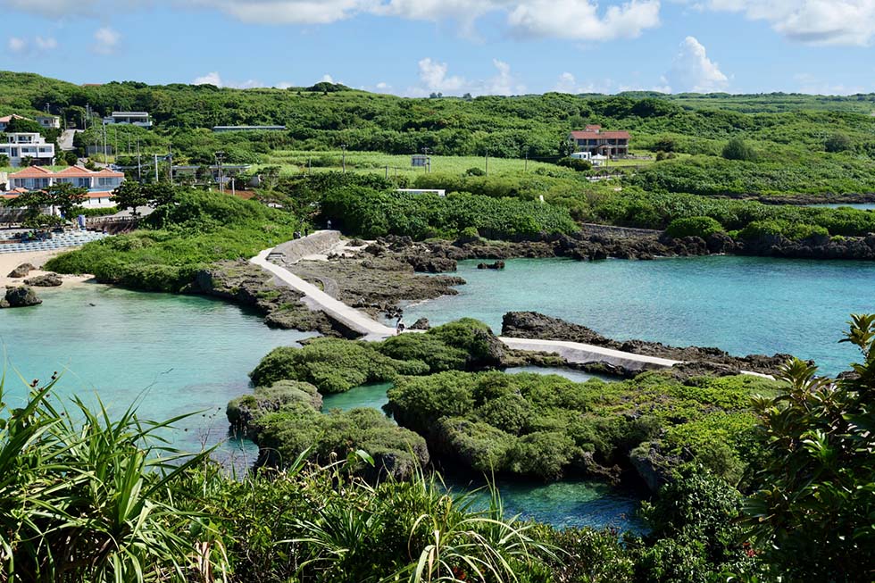
※ Imgya Marine Garden, Miyako Island

※ Fukuzato Underground Dam
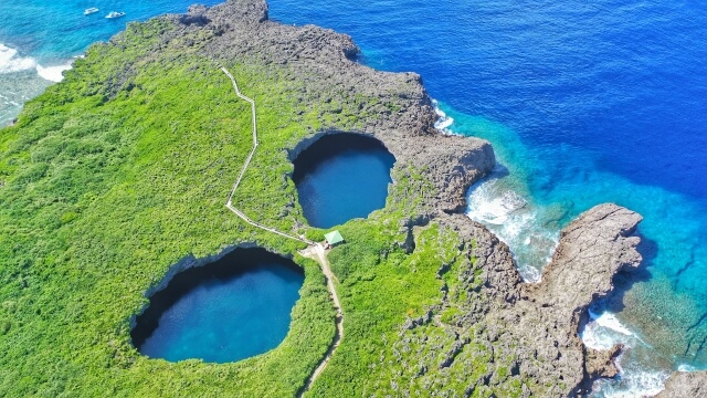
※ Toriike, which connects to the sea underwater
It is widely known that Miyako Island and the neighboring islands of Shimoji and Irabu contain many land caves and underwater caves.
Even in recreational diving, Miyako Island is so well known for cave diving that sites such as “Maou no Kyuden” and “Toriike” attract many divers from Japan and abroad.
At the same time, many subterranean lakes in the deeper parts of land caves have a history of being used as domestic water sources, and traces of daily life remain inside the caves.
For this reason, many of these caves and subterranean lakes have been designated as cultural properties or historic sites, and underwater investigations have generally not been carried out.
In that context, Professor Yoshihisa Fujita of Okinawa Prefectural University of Arts, with whom I had previously conducted cave research in other regions, consulted me about investigating the deeper underwater sections of subterranean lakes on Miyako Island that he had not been able to reach because of technical diving limitations.
Investigating unexplored areas that require advanced diving techniques is precisely the kind of challenge I should undertake as an underwater explorer, and after discussion with Professor Fujita, we decided to carry out this research.
At that time, the idea was that the work would proceed “if research funding could be obtained in the following fiscal year.” However, in discussing this, Professor Fujita and I realized that we shared the same concerns about that issue and about the broader way basic research is often conducted in Japan.
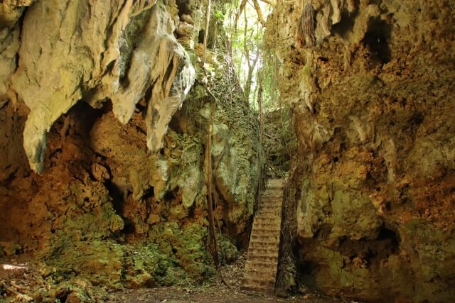
※ Nudokubi Abu on Irabu Island. Traces remain of its use by Japanese troops during the war.
During the planning of this research, we became aware of two major issues in conventional research methods.
Researchers are highly skilled at evaluating and studying the academic significance of information obtained from research sites. However, in environments such as underwater caves, advanced diving techniques and careful safety management are essential, and this greatly limits both the number of researchers who can dive and the range that can be investigated.
Underwater explorers, on the other hand, possess high-level diving skills and the ability to carry out field investigations, but there are limits to how far they can independently evaluate and communicate the academic significance of what they find.
Therefore, we believe that collaboration between researchers and underwater explorers could produce new research results by combining the strengths of both.
In general, many researchers in Japan have conducted research using funds allocated by their institutions and external research funding such as KAKENHI and other public or private grants.
Institutional research funds are often limited, while external grants have low acceptance rates and require a long time from application to decision. When applications are unsuccessful, repeated reapplications may be necessary, which has also been pointed out as a waste of researchers’ human resources.
This is especially true in biodiversity studies, where it is impossible to know in advance what organisms may be found in the field. Ideally, joint fieldwork involving taxonomists from multiple disciplines would be desirable, but because of limitations in budget and personnel, such fieldwork is often difficult to carry out.

These two issues can ultimately be summarized as the inability to secure flexible funding for sufficient work in the initial stage.
For that reason, in this project we explored a new framework: to conduct initial investigations efficiently, make the research value visible at an early stage, and then connect that value to funding for the next phase of research.
More specifically, we are considering crowdfunding and small-scale sponsorship from individual supporters and companies by offering, for example:
If this system works, it could make it possible to expand investigations into places that previously could not be studied for budgetary reasons, and it may accelerate future research outcomes.
For the March 2026 investigation, we selected the following three caves.
Miyako Island has many other springs and subterranean lakes, and we intend to extend the scope to them in the future.
The subterranean lakes in all of these caves are thought to be anchialine environments*, and are expected to contain previously undescribed species and other unusual organisms.
*Anchialine environments are special groundwater systems located inland but connected to the sea underground, where freshwater and seawater mix and stratify.
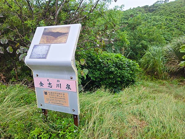
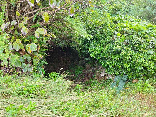
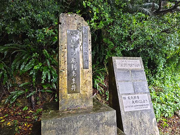
Pottery and bones believed to be human have already been found underwater in Kinsukya-ga, and further archaeological and biological discoveries may be expected in the unexplored sections deeper inside the cave.
Pikyazu is a doline that opens through to the sea. According to a report published in October 2016 in the Bulletin of National Institute of Technology, Sasebo College, No. 53, investigators were able to proceed to a point about 20 meters from the water surface and about 11 meters in depth, and confirmed water flow from deeper inside, but had to suspend the investigation there because of silt accumulation.
In this project, we aim to confirm whether it is possible to reach beyond that point. Regardless of whether that proves possible, we also plan to conduct biological investigations focusing on the mixing zone between the lower-salinity flow coming from deeper inside and the more saline seawater.
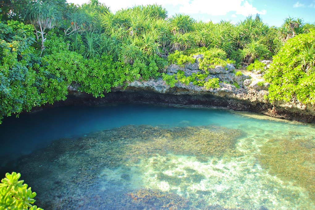
※ Near the water surface of Pikyazu
After discussions with Professor Fujita and members of JKUEP (Japan Karst & Underwater Exploration Project), the period for the investigation was set for March 5 to 9, 2026.
To address the issues described above, Atsushi Hayashida, who can carry out surveying in land caves, Yudai Uchida, a cameraman capable of underwater and topside imaging, and archaeology researchers were also scheduled to take part in this research.
As described below, the scope of work was defined in advance. Among these items, underwater cave surveying and 3D mapping are especially important. Although they are fundamental data for academic research, there are still few specialists in Japan with these skills, and we believe the data obtained in this research will make a significant contribution to future studies.
Before the main research, in November 2025 I carried out a preliminary investigation with underwater photographer Jun Shimizu, after filing the necessary notifications with Okinawa Prefecture and Miyakojima City.
This was done to secure transport routes for diving equipment and to confirm the environment in advance. It may sound excessive, but I believe this kind of preparation is extremely important for efficient and safe research.
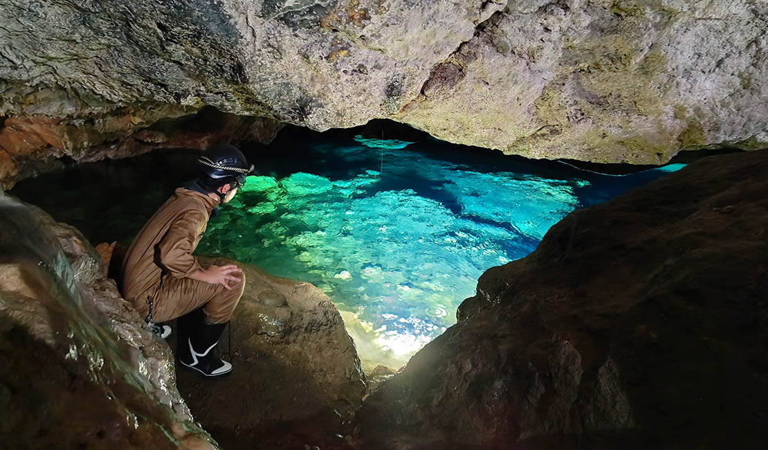
※ Beautiful water surface of Kinsukya-ga
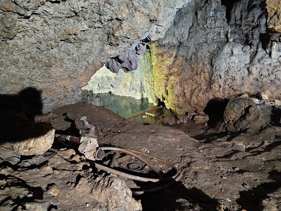
※ Inside the cave of Amaga of Tomori, and its water surface
On that day, not only Jun Shimizu and I, but also NHK staff who were interested in the research accompanied us. Although the weather was poor, we inspected the research sites and considered routes and logistics.
The water surface of Kinsukya-ga was remarkably beautiful and made me feel that I wanted to dive there immediately.
Of course, its importance is not only aesthetic. Pottery has been confirmed on land, and in the water, pottery as well as bones believed to be human have been found, making it a cave of great academic value.
The water surface of Kinsukya-ga rose and fell with the tides, as expected from prior information, suggesting a connection with the sea inside the spring.
At Amaga of Tomori in Gusukube-Cho, Professor Fujita discovered larvae of marine organisms even though the site is inland.
The presence of larvae of marine organisms strongly suggests that this site too is connected to the sea underwater. Further biological research here may contribute to clarifying how organisms inhabiting such anchialine environments disperse.
In addition, the steps inside Amaga of Tomori, which were installed to draw water, reminded us that this water was once used in daily life.
We also received information about the research sites from staff of the Miyakojima City Board of Education. I would like to record my sincere thanks here.
This preliminary research was covered by NHK Okinawa, Ryukyu Shimpo, and Miyako Mainichi Shimbun.
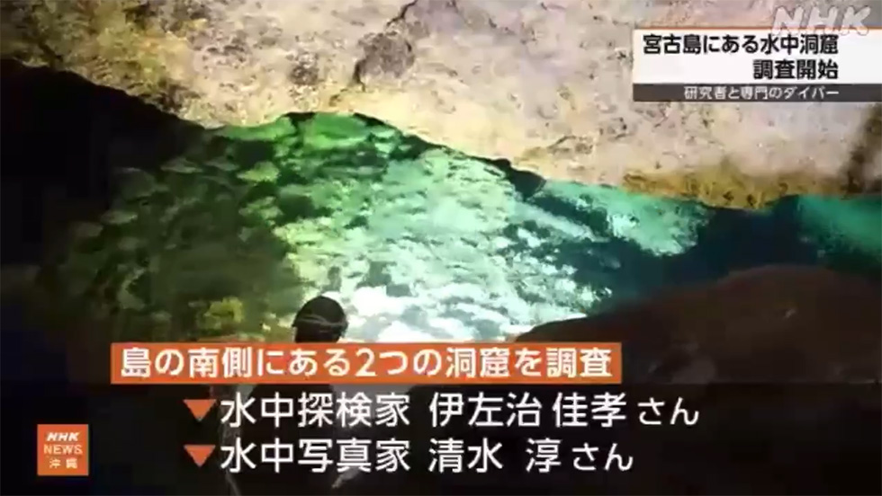
※ From the NHK Okinawa broadcast of November 13, 2025
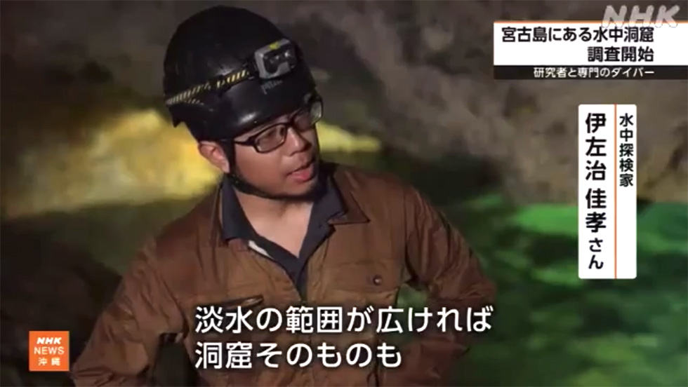
Related coverage (November 2025 preliminary research)
Following the preliminary research in November 2025, the team assembled on Miyako Island on March 4, 2026: Atsushi Hayashida, Yudai Uchida, and I for the diving, together with Professor Yoshihisa Fujita (Okinawa Prefectural University of Arts) and archaeologist Seita Gushiken (Okinawa Prefectural Board of Education) on the research side. With permission from Okinawa Prefecture and Miyakojima City, we carried out dive investigations at three sites: Kinsukya-ga, Pikyazu, and Amaga of Tomori.
On the day before the investigation, the whole team met to go over research methods and prepare the equipment.
We dived Kinsukya-ga on March 5 and 8, and Pikyazu and Amaga of Tomori on March 7.

※ All members of the March 2026 investigation

※ Underwater in Kinsukya-ga

※ Artifacts believed to be Miyako-type pottery
In November I wrote that the water surface of Kinsukya-ga made me want to dive there immediately. On March 5, we finally did.
When I tasted the water on entering, it was saltier than I had expected, a hint of the connection to the sea.
The water was clear, with visibility of 10 to 12 meters, and there was not much silt on the bottom.
The main passage is no deeper than 5 meters, and the deepest point is about 10 meters. As we laid line through the whole cave, including the narrow passages, and moved deeper in, bones and pottery kept appearing within reach of our lights.
Bones believed to be human, and pottery, lie scattered from near the entrance to the far end of the passage, in quantities too great to describe in full.
Gushiken examined the pottery for us and gave his opinion that it is Miyako-type pottery. Underwater we also observed objects that appear to be ornaments.
Why are bones and pottery scattered all the way to the far end of the passage?
Miyako is known to have had a tradition of cave burial (fuso, or exposure burial), so the presence of bones and pottery in a cave is not in itself unusual.
But burial deep inside the cave, throughout its length, looks unnatural, and it is possible that remains once placed near the entrance of a burial cave were later carried deeper in.
Gushiken also offered the view that they may have been washed in from other burial sites outside the cave by the Great Meiwa Tsunami of 1771.
Our role is to bring information back from underwater and hand it to researchers as material they can judge. This record is the first full set of that material.

※ Bone-like objects observed inside the cave

※ Removing tanks in the air dome to climb onto dry land
Inside the cave there is a place where an air dome allows you to climb out onto dry land, and bones can be seen on that land as well.
Insects were observed there, suggesting a connection to the outside. If the passage could be entered from another entrance, it would raise the possibility that the bones and pottery were placed directly in the far end of the cave, so on March 8 Hayashida checked. At least at present, there is no passage large enough for a person to pass through.
The far end of the main underwater passage appeared to be blocked by a collapse. We threaded our way between the fallen rock as far as we could, but in the end the gap was no longer large enough for a person to pass.
Space probably continues beyond the collapse, but for now there is no way to get there. We also confirmed two side passages: one that drops to about 10 meters and silts up easily, and a narrow one that branches off to the side. Pottery and bones were observed at the far end of the deeper side passage as well, and it is hard to imagine that anyone came this far into a side passage to lay remains to rest.
The total length of line we laid, including the side passages, is roughly 120 meters. This is an estimate from the length of line used, not a surveyed value.
Kinsukya-ga has been dived several times in the past, and ours was not the first dive here. However, apart from the work of Professor Fujita, who joined this investigation, no academic investigation of the underwater section has previously been reported.
The saltiness I had tasted showed up directly in the numbers.
Starting at 11:40 on March 8, we sampled water at eight points from the surface down to 10 meters. Salinity was 7.62 PPT at the surface, 9.06 at 1 meter, 11.61 at 3 meters, 14.10 at 7.5 meters, and 15.46 PPT at 10 meters. Rather than a boundary at some depth, the water simply becomes steadily saltier with depth, and we found no sign of stratification. This matches what we saw with our own eyes. We felt no current while diving; pH was 7.08 to 7.24, and the water temperature was 23 to 24°C.
A certain number of the small crustaceans that live in anchialine caves were observed underwater, but not in great abundance.
These are observations from a single day in March. The values are likely to differ with the time of measurement, depending on rainfall, season, and the tides.

※ Part of the measurement data from this investigation

※ The water surface of Pikyazu

※ Following the flow of water into the cave
Pikyazu is a collapse-doline-like feature in the sea. We swam out from the beach with underwater scooters and approached it from the seaward side.
Our original plan was to focus the biological investigation on the zone where flow from deeper inside meets seawater. Once in the water, however, we found the water being drawn strongly inward toward the far end. The marine influence was so strong that this was not an anchialine environment in the usual sense.
With Hayashida leading, we began the dive and reached the point at 11 meters' depth that the 2016 report by Hiroki Manabe and colleagues of National Institute of Technology, Sasebo College gave as their farthest point. It looked possible to go further, but from there the passage narrows, and the inward suction becomes even stronger.
If all three of us went in at once, anyone who became stuck might not be able to get back out, so Uchida and Hayashida waited while I went ahead to check whether the passage continued.
In a narrow passage, going in head-first without knowing whether there is room to turn around is extremely dangerous.
Feet first, I worked my body slowly into the gap. At around 20 meters' depth, I found water being drawn with great force into a gap between rock above and below, about 20 to 30 centimeters high and about 1 meter wide. It is not large enough for a person to pass, and this became our farthest point.
The 2016 report describes flow coming from deeper inside; on this dive, the flow was being drawn inward.
The part a person can pass through ends here, but the water keeps being drawn in beyond it. The cave interior is a fully marine environment, and the organisms are the same as those in the surrounding sea, so it seemed difficult to keep it as a subject of this research any further.
This is one settled record about this place: the next person to ask a question about Pikyazu can start from here.
In that sense, I think we have done our part.

※ Team members waiting while Isaji checks the far end

※ Isaji emerging from the narrow restriction

※ The water surface of Amaga of Tomori seen from land
The subterranean lake of Amaga of Tomori is a well at the bottom of a vertical shaft, and from land it was not certain that the spring continued far enough to be dived.
On March 7, the day of the investigation, Hayashida free-dived to check the back of the spring and confirmed that a cave continued beyond it, so we decided to dive.
As far as the records held by the boards of education of Okinawa Prefecture and Miyakojima City go, we were told this is the first permission for an alteration of the existing state involving diving. Underwater there was no trace of previous diving other than the line we had laid, so it seems fair to say that this was the first dive in Amaga of Tomori.
From the back of the spring the bottom slopes down to about 3 meters, and from there it is level.
Silt has settled on the bottom; rather than level ground, it is level because of the silt that has accumulated there.
Following the left wall for about 15 meters, we came to a chamber about 10 meters wide, with fine stalactites. It is a splendid underwater cave.
Straight on from there, the passage dead-ends after about 15 meters. This dead end was confirmed by Hayashida and comes from his report; I was last of the three and waited before it because of the silt-out.
My feeling is that, as reported, it does not extend much further, but we will check again next time.

※ Underwater in Amaga of Tomori

※ The floor of Amaga of Tomori; crustaceans are visible
This cave silts out very easily.
In addition to the thick silt on the bottom, percolation (sediment dislodged from the ceiling by exhaled bubbles) is severe, and if you stay in one place the visibility is gone in no time.
On the way out, of course, visibility was zero.
Even when it is not silted out, visibility is only about 5 meters, which is why we were able to check only along the left wall. The right wall is a task for next time.
Organisms, on the other hand, were plentiful: we observed a great many of the crustaceans that live in anchialine environments.
This suggests that, because Amaga of Tomori is a vertical shaft, a large amount of organic matter enters the water, which means plenty of food.
We did not measure the water, but it seemed fresher than Kinsukya-ga. This is an anchialine environment, but the connection to the sea appears to be weak.
Next time, if time allows, we would also like to observe how the water level changes with the tides.
This investigation completed dives at all three sites without incident and gave us a picture of the different cave environments that exist within a single island.
At Kinsukya-ga and Amaga of Tomori, I think we have also seen what our next tasks should be.
Amaga of Tomori in particular appears to have been dived by no one but us so far, so there is no underwater information about it anywhere. We want to give priority to gathering basic information there and reporting it to the boards of education and other authorities.
Miyako Island and the neighboring islands have many other caves, and some places are likely to have subterranean lakes that can be dived.
We hope to widen the scope of our activities and take on those investigations.
Related coverage (March 2026 investigation)
*Affiliations may not be up to date.



Copyright © 2024 Japan Karst & Underwater Exploration Project