
Kirishima, in Kagoshima Prefecture, is a land of water. The rain stored by the Kirishima mountains travels underground and rises in springs across the foot of the range, sustaining people's lives. And that water does not only flow above ground: inside the land the volcanoes built, it has been carving out spaces that no one has yet seen.
This project investigates the "inside of the water" of Kirishima. Working with a local research team, we dive the places that robots have peered into but no human has yet entered to confirm — underwater caves and the underwater sections of springs — to measure and to record.
The first sites are Shimono Dai-2 Doketsu, a cave, and Odemizu Spring, both in Yokogawa, Kirishima City. At Shimono Dai-2 Doketsu, the subject is the underwater cave — and the pottery-like object on its floor — that a research team led by Specially Appointed Associate Professor Hiroki Manabe (National Institute of Technology, Sasebo College) confirmed and discovered through investigation with an ROV (underwater drone). At Odemizu Spring, we investigate the underwater side of the spring vent.
Unmanned exploration by ROV, and diving by humans. We see this collaboration as a demonstration of complementary methods of investigation, in which researchers and working divers each bring their strengths.
Kirishima City sits near the centre of mainland Kagoshima Prefecture, with the Kirishima mountain range to its north and, to the south, Kinko Bay looking across to Sakurajima. Yokogawa is a town in the hills, looking east to the Kirishima range. The name of the Amori River — literally, "the river descended from heaven" — which flows through the town, is said to derive from an Edo-period gazetteer that placed its source in Mt. Kirishima, held in legend to be the site of Tenson Korin, the heavenly descent.
In 1889 (Meiji 22), the three villages of Kamino, Nakano and Shimono merged to form Yokogawa Village; it became a town in 1940 and, in the municipal merger of 2005, part of Kirishima City. Shimono Dai-2 Doketsu and Odemizu Spring — the sites of this project — both lie in this "Shimono."
Yokogawa is also a land with deep layers of history. In the Edo period it prospered on the Yamagano Gold Mine, which supported the finances of the Satsuma domain; at Osumi-Yokogawa Station, opened in 1903 (Meiji 36), one of the oldest wooden station buildings in the prefecture is still in service, its pillars carrying scars of machine-gun strafing from the Second World War. In the gorge of the upper Amori River in the Shimono district stands the Iwado Kannon, a Buddhist image carved into the rock face and a prefecturally designated cultural property. Mountains, water, and the long presence of people, layered together in one land.
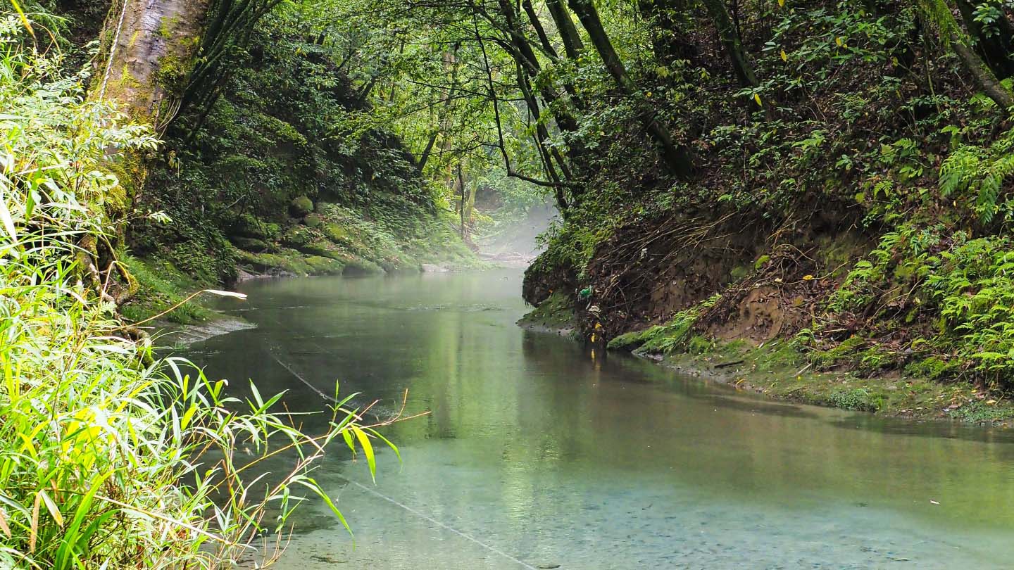
※ Downstream of Odemizu Spring
The underground rivers of Akiyoshidai, the fresh water beneath Minami-Daito Island — most of the water we have dived until now belonged to worlds made by limestone. Limestone dissolves in water; the dissolved gaps become caves, and the caves become the paths of water. Most of the world's underwater caves lie in this "dissolving rock."
Kirishima is different from them all.
The Kirishima mountains are among the rainiest places in Japan. Ebino Plateau, at 1,200 metres, is said to receive an average of 4,400 mm of rain a year — roughly three times that of Tokyo. Most of that rain does not run off over the surface: it soaks into the volcanic ground, becomes groundwater, travels through the mountain's interior, and emerges as springs across the foot of the range. Kirishima is called a land of water because this vast mechanism exists.
Odemizu Spring is one of its outlets. Twenty-two tonnes a minute — about 110 household bathtubs (200 L each) — still rises here today. Water that has travelled long underground holds a stable temperature through the year, whatever the heat or cold of the air outside.
So what is this water passing through? The underground of Kirishima is built of pyroclastic-flow deposits laid down by volcanic eruptions. As cave-forming geology this is the "third kind," after limestone and basaltic lava flows, and such caves are few (according to an article by the National Institute of Technology, Sasebo College). Where limestone becomes space by "dissolving," the pyroclastic land becomes space by being "carved": a hard, consolidated layer remains as the ceiling, while the softer layer beneath is cut away by groundwater.
This region holds a leading example. Mizonokuchi Cave in Soo City — at 209.5 m in total length, one of the largest caves in Japan formed in a pyroclastic plateau, and a National Natural Monument. It is explained (by Soo City and the Kagoshima Prefectural Museum) as having taken shape when the Ito pyroclastic flow (shirasu), erupted from the Aira caldera about 29,000 years ago, left its welded, hardened part as a ceiling while spring water from the Kirishima range carved away the non-welded part below. The water of Kirishima digging into the pyroclastic land — in this region, that has actually happened.
In this region, the insides of caves have been measured — Mizonokuchi Cave, the Natural Monument, among them — and the waters have been measured too, as famous springs, for discharge and for temperature. Two bodies of records, built up over a long time.
And in them, one blank remained. Only what lies under the water had yet to be measured.
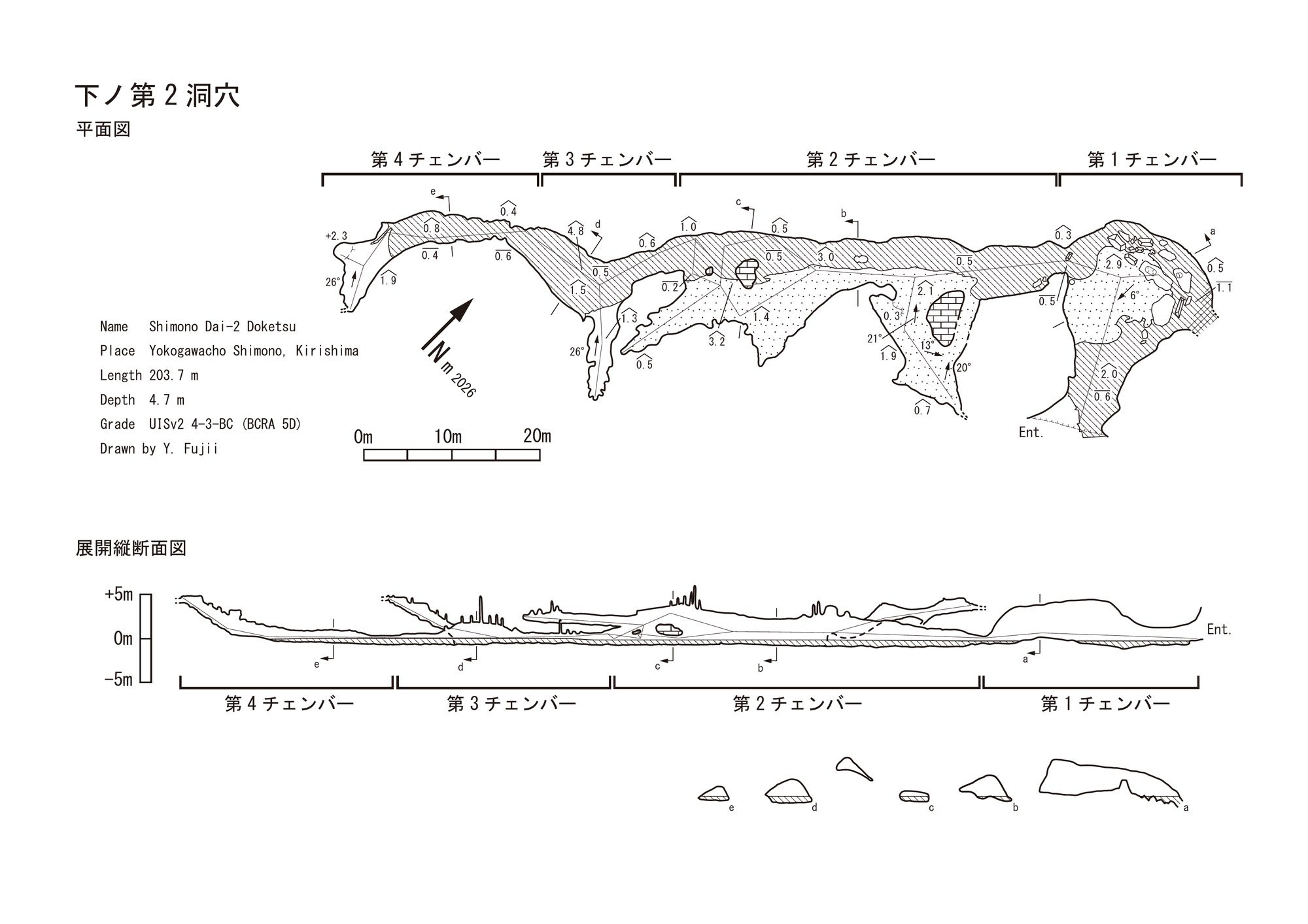
An unmanned surface vehicle (USV) confirmed a passage-like cave beyond the entrance, and recorded a hall-like chamber (Chamber 1) together with a flooded section; an ROV survey below the waterline of that flooded section was set as the next step. Underwater photography of the flooded section followed in March 2026, and cave surveying and 3D measurement (producing the survey map shown below) in March–April.
Then, on 26 April 2026, an ROV dive indicated that the water might continue beyond the flooded section — and captured, on its floor, an object that could be seen as a fragment of broken pottery.
The object remains on the cave floor as found; verifying it in person and assessing its details are left to further investigation and study.
The full account of the discovery is given in the official article (in Japanese) by the National Institute of Technology, Sasebo College.
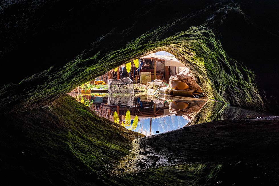
※ A chamber inside Shimono Dai-2 Doketsu / Photo: Yuki Fujii
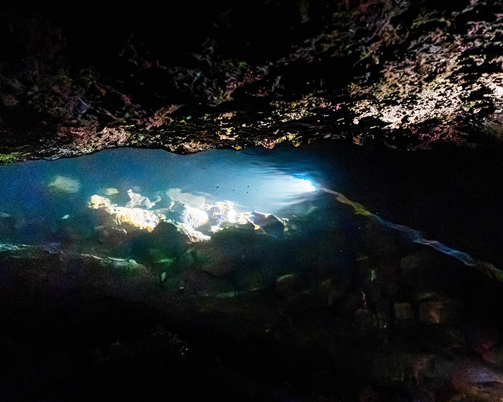
※ The flooded section inside Shimono Dai-2 Doketsu / Photo: Yuki Fujii
An ROV (underwater drone) greatly extends the reach of investigation into underwater spaces that people cannot easily enter.
At the same time, delicate recording and measurement in tight spaces and clouded water cannot be completed by an ROV alone. And if an ROV becomes entangled or otherwise immobile underwater, rescue and recovery by a diver becomes necessary.
Robots widen the possibilities; humans make them certain. And the measured data obtained by human diving is used to verify the ROV's measurements, raising the precision of the next unmanned exploration.
And it is not only the logic. Beyond the waterline, the survey map was still blank.
To take on the task of verifying the pottery-like object the ROV had captured, and to draw the first survey lines into the blank of the map with our own hands — frankly, these are things that make the heart race.
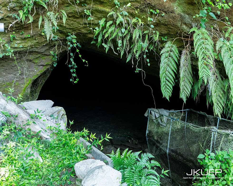
※ Near the entrance of Shimono Dai-2 Doketsu / Photo: Yuki Fujii
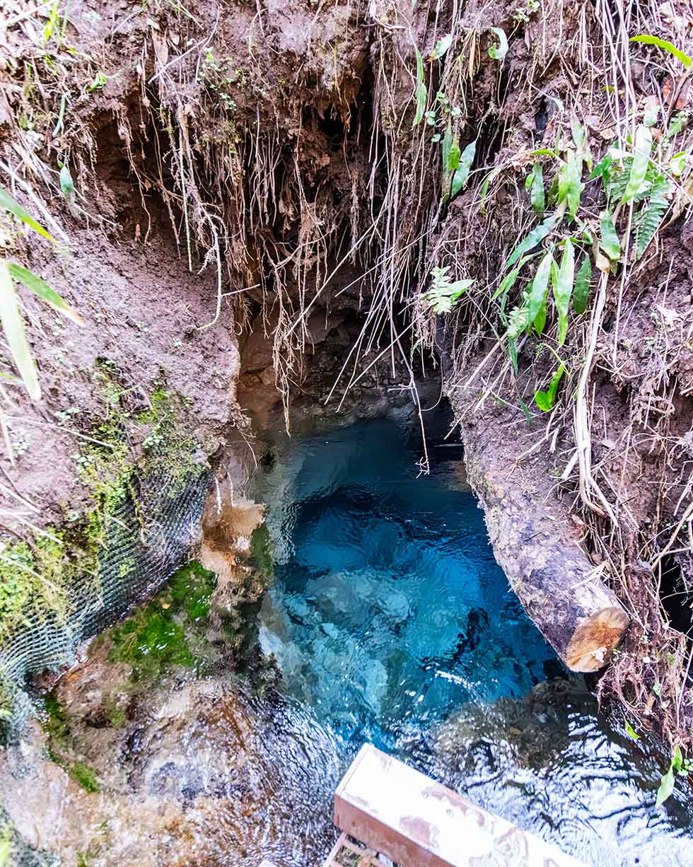
※ The discharge point of Odemizu Spring / Photo: Yuki Fujii
Odemizu Spring lies beside the Kurumi River, a tributary of the Amori River: from the bottom of a rock-ringed vent, twenty-two tonnes of water rise every minute. A hand pump lets people draw the water, and visitors from inside and outside the district come in a steady stream — for diluting shochu, for cooking rice.
In the record-breaking rains of August 2025, flooding of the Kurumi River damaged the steps and revetment of the water-drawing site; after restoration work, use resumed in February 2026. That, too, is a measure of how deeply this water is rooted in local life.
What lies beyond that vent is not yet known. Whether a space continues under the water — this investigation begins by confirming exactly that.
We decided that the dives this time would be carried out by two divers: Yoshitaka Isaji and Hirokazu Mori.
What spreads beyond the map of Shimono Dai-2 Doketsu? When we see with our own eyes the pottery-like object the ROV captured, what will we learn?
And beyond the vent of Odemizu — does an underwater space continue?
When the underwater survey lines connect to the map of the dry cave, the full picture of Shimono Dai-2 Doketsu will become, for the first time, a single drawing.
To leave that drawing, the record of the object on the cave floor, and what we confirm at Odemizu Spring in a form that can be handed over — to the research team that has carried this investigation from the discovery to here, and to this land. That, we believe, is the role we take on in this investigation.
The precise location of Shimono Dai-2 Doketsu (route, coordinates, etc.) is withheld for the protection of cultural properties and for safety.
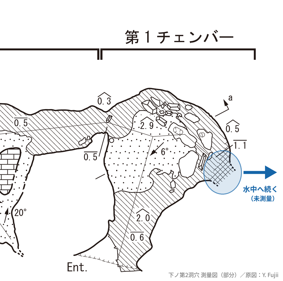
※ Shimono Dai-2 Doketsu: candidate entry point to the underwater section (around Chamber 1)
The day before the dives, we appeared on the community radio station FM Kirishima. We wanted to tell the people of this area first, in our own words, what we had come to investigate.
We talked with the presenter and heard reactions from listeners. Exchanging words with the people of the place where we dive, before we dive, is something we believe genuinely matters.
What we learn here, we hope to return to the people of this land. And we hope to report back on the investigation from this same studio.
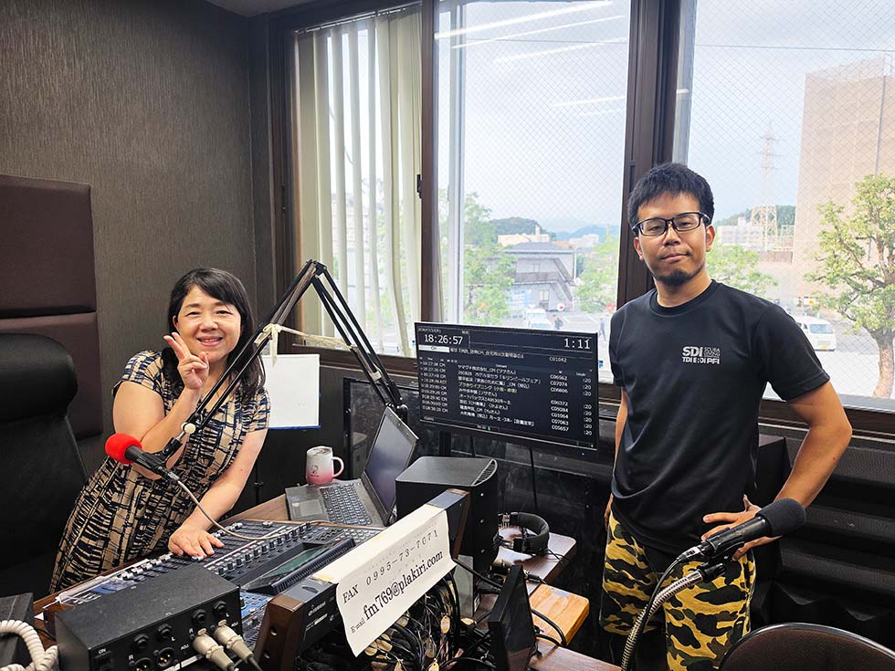
※ At the FM Kirishima studio with presenter Junko Koike
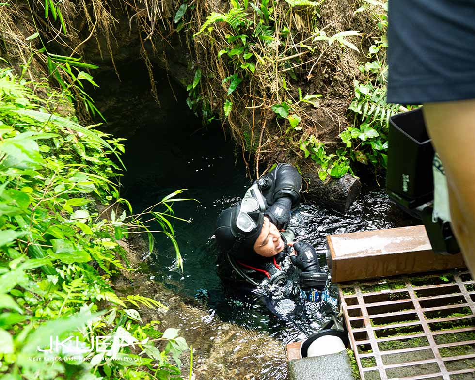
※ Scenes from the underwater investigation
※ The vent of Odemizu Spring
On the day after we arrived on site, the first place we dived was Odemizu Spring. The source of twenty-two tonnes of water a minute — we began by confirming whether a space continues beyond the mouth of the spring.
Odemizu is the water of daily life here. Throughout the investigation, people kept coming to draw water, and many of them spoke to us.
It brought home to us how deeply a spring can be rooted in everyday life, and renewed our sense that what we clarify underwater in Kirishima should be returned to the people of the area.
We entered at the spring mouth and went straight down: 2 metres.
At the bottom, water was gushing out from the side — with enough force to push against the regulator — and a rock sat wedged in the outlet. The space continues beyond it, but not at a size a person can enter.
I had imagined something like an underground lake; it was more like a "hose" — utterly different. That so much water comes out of such a small conduit was, for me, the greatest surprise.
The confirmation of Odemizu's underwater section was settled in this one short dive.
We decided to give the remaining time to Shimono Dai-2 Doketsu, and that same afternoon, ahead of schedule, we moved to the second site.
In this investigation, from the afternoon of the 24th through the 25th, we dived the underwater section of Shimono Dai-2 Doketsu.
What we dived was the flooded section that had been blank on the survey map.
Once underwater, we found much of it to be narrow passage with little more clearance than the thickness of a diver's body — with many points that cannot be passed in conventional back-mounted equipment — passable only in sidemount configuration.
On the floor lies a thick layer of fine sediment, apparently shirasu (a volcanic pyroclastic deposit), which clouds the water at the slightest movement.
In that environment, together with Mori, we worked our way through the water, checking the underwater structure that the ROV had not been able to fully confirm.
We were able to confirm underwater sections that had not appeared on the existing land survey map. On the other hand, at the spot we had seen as possibly continuing onward, it was closed beyond that point.
According to research by Hiroshi Takashima of Daiichi Institute of Technology, this cave's discharge is put at roughly 28 tonnes per day — about 19 litres per minute. The flow we felt underwater was likewise very weak, consistent with that figure, and did not give the impression of a "watercourse."
The walls, unlike limestone, looked to me like welded tuff. We photographed the walls and the bottom sediment as well, in a form that researchers can examine.
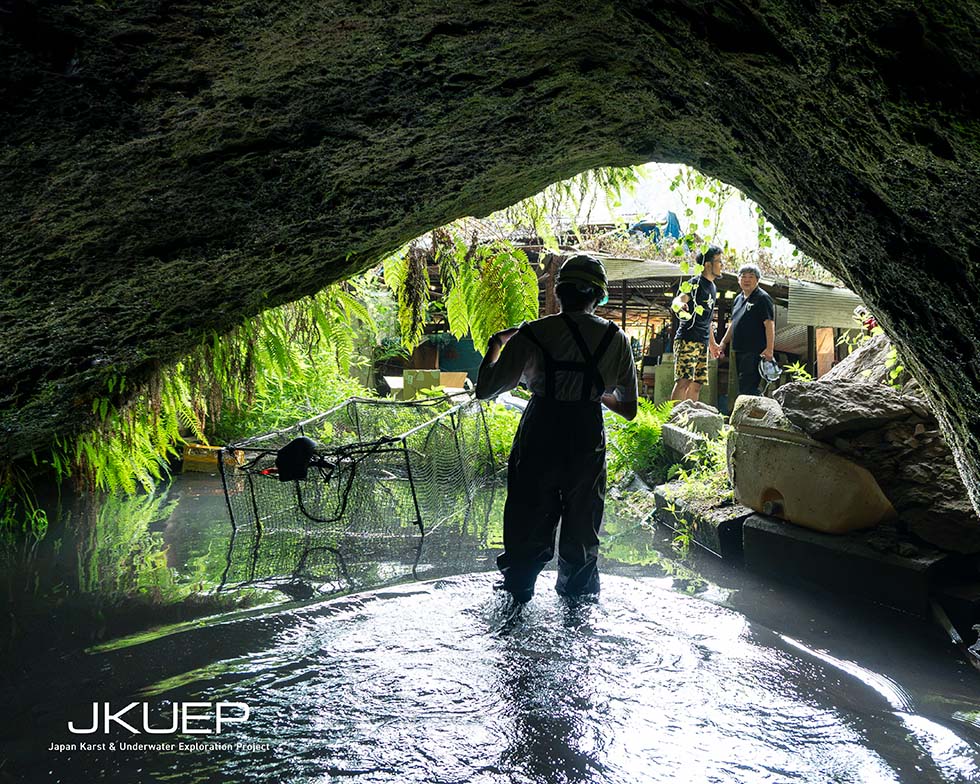
※ Inside Shimono Dai-2 Doketsu
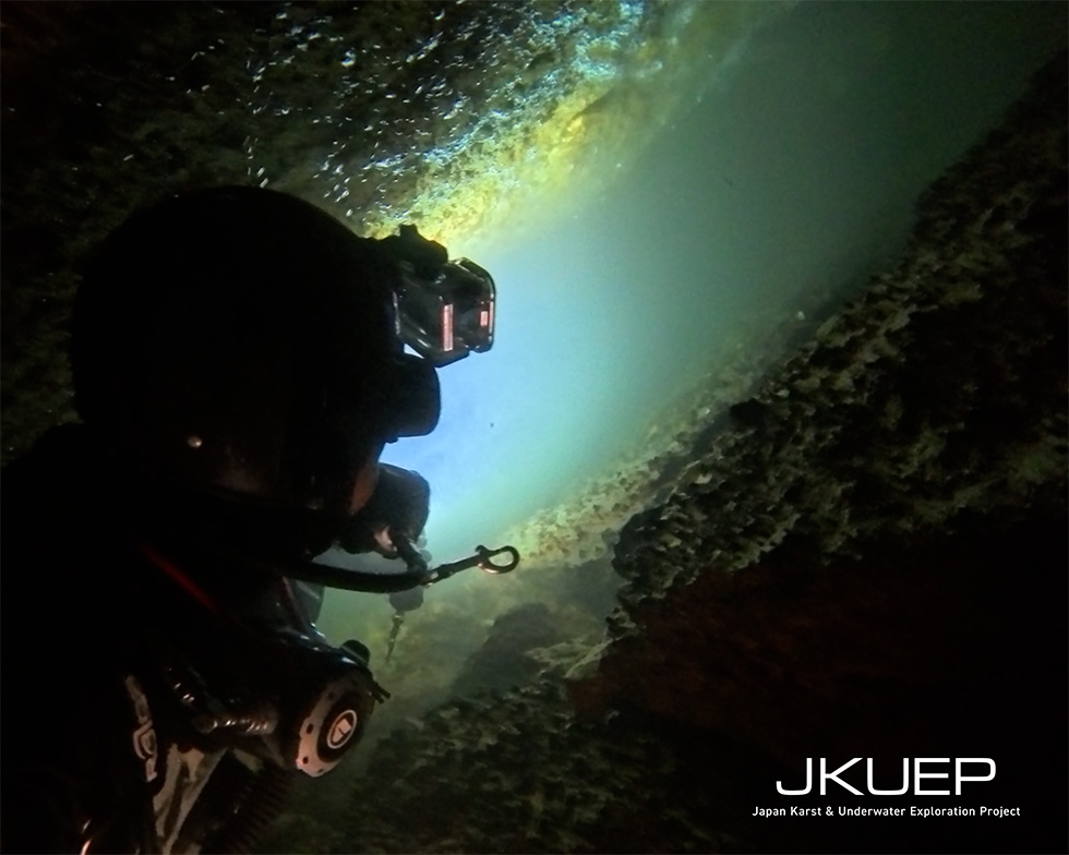
※ Underwater in Shimono Dai-2 Doketsu. Passages of about this size continue throughout.
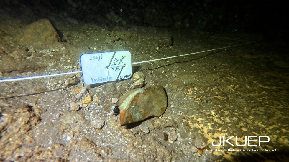
※ The vessel-fragment-like artifact and the marker
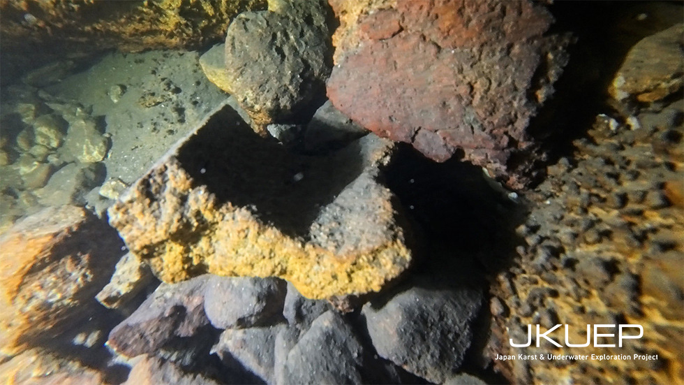
※ Block-shaped pieces apparently broken from something kamado-like
The other task of these dives was to verify the pottery-like object that the ROV had captured on the cave floor. That object could not be confirmed in these dives.
On the other hand, separate from the object we had marked as the candidate before this investigation, we discovered a number of artifacts and traces of human activity.
What we newly found underwater are the following six items:
On this occasion we limited ourselves to documenting these finds; we did not raise or remove anything.
What they are, and when they date from, we wish to leave to the specialists.
To the vessel-fragment-like artifact, we laid a line running straight from the dry part of the cave and set a marker at its position. It is there so that the next dive can return directly to the spot — and the marker also doubles as a scale for dimensions.
Each artifact was photographed for photogrammetry (3D imaging); assembling the models is still to come. We also compiled the approximate positions of the artifacts and the outline of the underwater section into a single drawing.
With these in place, we believe that when we or others return for further investigation, the work can start from a record rather than from zero.
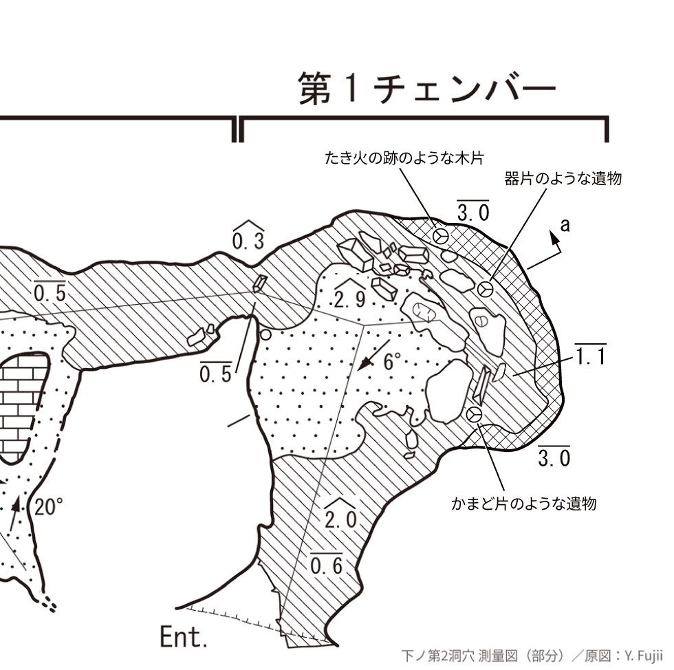
※ The underwater section of Shimono Dai-2 Doketsu — approximate artifact positions and outline (base map: Y. Fujii / drawing: Yoshitaka Isaji)
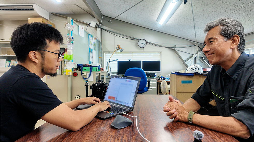
※ At Hiroshi Takashima's laboratory
On the same day the dives ended, we visited Hiroshi Takashima at his laboratory at Daiichi Institute of Technology. Takashima is the geologist who discovered and named Shimono Dai-2 Doketsu, and a collaborator in this investigation. We brought him what we had seen underwater, and asked how the water of this land works.
As he explained, the ground of this area is built of two layers. Below lies the Kakuto pyroclastic-flow deposit — from an eruption 340,000 years ago, by his account — weathered and clogged inside, and poor at passing water. On top of it sits the highly permeable Ito pyroclastic-flow deposit (about 29,000 years ago). The word "shirasu" tends to be used loosely, he told us, but in the strict sense it refers to this Ito pyroclastic-flow deposit. The volcanic ash from that eruption was on a scale found as far away as Hokkaido.
Within that frame, the two waters take different shapes. The water of Shimono Dai-2 Doketsu seeps out at the boundary between the Kakuto and the Ito — unconfined groundwater, under no pressure. It does not yield a large discharge. The water of Odemizu Spring rises from below, up through the Kakuto — confined groundwater, under pressure. That is why the discharge is large. The two sets of observations we made underwater each find their place in this framework.
The Ito has no impermeable layer — so why is the water below it under pressure? Takashima thinks that the upper part of the Kakuto has weathered into soil, forming a clay layer that may act as a lid.
When I told him what I had felt in the water at Odemizu — this rock does not dissolve in water — his answer was immediate: limestone dissolves in water; tuff does not. Landforms in tuff are shaped not by dissolving, but by being carved by water. The difference between the world of "dissolving rock" we have dived until now and the world of "carved rock" in this land — we feel the researcher himself has borne it out for us.
The 3D measurement of the underwater section was set aside this time because of the sediment clouding the water, and carried over to the next visit. The line to the artifact positions remains in place, so the next dive can go straight to them. Assembling the photogrammetry models is also work still ahead.
We reported the results up to that point to the Kirishima City Board of Education on the evening of 25 July.
Then, on 26 July, a new cave — its interior flooded — was discovered.
I had already left the site at that point, and a sufficient diving investigation could not be carried out by those remaining on site alone. There may well be more to find.
The data from this investigation, the records of the artifacts, and the drawing of positions and outline have been provided to Manabe, Takashima, and the relevant authorities. "To leave it in a form that can be handed over" — this, too, is the carrying out of the role we set down before the investigation.
For this investigation, we are deeply grateful to Specially Appointed Associate Professor Hiroki Manabe and everyone on the research team, to Hiroshi Takashima, and to the people of the area who spoke to us at Odemizu Spring.
Related Media Coverage (on the July 2026 investigation)



Copyright © 2024 Japan Karst & Underwater Exploration Project